
Chapter 3
We saw that the Mercator World Map of 1569 included an accurate portrayal of the coasts of Antarctica as they would have looked thousands of years ago when they were free of ice. Interestingly enough, this same map is considerably less accurate in its portrayal of another region, the west coast of South America, than an earlier (1538) map also drawn by Mercator.1
The reason for this appears to be that the sixteenth-century geographer based the earlier map on the ancient sources which we know he had at his disposal, whereas for the later map he relied upon the observations and measurements of the first Spanish explorers of western South America. Since those explorers had supposedly brought the latest information back to Europe, Mercator can hardly be blamed for following them. In so doing the accuracy of his work declined: instruments capable of finding longitude did not exist in 1569, but appear to have been used to prepare the ancient source documents Mercator consulted to produce his 1538 map.2
The mysteries of longitude
Let us consider the problem of longitude, defined as the distance in degrees east or west of the prime meridian. The current internationally accepted prime meridian is an imaginary curve drawn from the North Pole to the South Pole passing through the Royal Observatory at Greenwich, London. Greenwich therefore stands at 0° longitude while New York, for example, stands at around 74° west, and Canberra, Australia, at roughly 150° east.
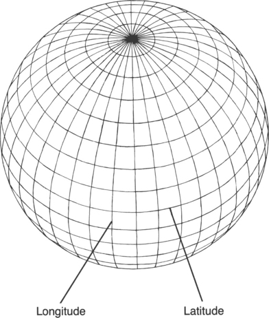
It would be possible to write an elaborate explanation of longitude and of what needs to be done to fix it precisely for any given point on the earth’s surface. What we are concerned with here, however, is not so much technical detail as the accepted historicalfacts about humanity’s growing knowledge of the mysteries of longitude. Among these facts, this is the most important: until a breakthrough invention in the eighteenth century, cartographers and navigators were unable to fix longitude with any kind of precision. They could only make guesses which were usually inaccurate by many hundreds of miles, because the technology had not yet been developed to allow them to do the job properly.
Latitude north or south of the equator did not pose such a problem: it could be worked out by means of angular measurements of the sun and stars taken with relatively simple instruments. But to find longitude equipment of an altogether different and superior calibre was needed, which could combine position measurements with time measurements. Throughout the span of known history the invention of such equipment had remained beyond the capacities of scientists, but by the beginning of the eighteenth century, with rapidly increasing sea traffic, a mood of impatience and urgency had set in. In the words of an authority on the period, ‘The search for longitude overshadowed the life of every man afloat, and the safety of every ship and cargo. Accurate measurement seemed an impossible dream and “discovering the longitude” had become a stock phrase in the press like “pigs might fly”.’3
What was needed, above all else, was an instrument that would keep the time (at the place of departure) with perfect accuracy during long sea journeys despite the motion of the ship and despite the adverse conditions of alternating heat and cold, wet and dry. ‘Such a Watch’, as Isaac Newton told the members of the British government’s official Board of Longitude in 1714, ‘hath not yet been made’.4
Indeed not. The timepieces of the seventeenth and early eighteenth centuries were crude devices which typically lost or gained as much as a quarter of an hour per day. By contrast, an effective marine chronometer could afford to lose or gain that much only over several years.5
It was not until the 1720s that the talented English clockmaker John Harrison began work on the first of a series of designs which resulted in the manufacture of such a chronometer. His objective was to win the prize of £20,000 offered by the Board of Longitude ‘for the inventor of any means of determining a ship’s longitude within 30 nautical miles at the end of a six weeks’ voyage’.6 A chronometer capable of fulfilling this condition would have to keep time to within three seconds per day. It took almost forty years, during which several prototypes were completed and tested, before Harrison was able to meet these standards. Finally, in 1761, his elegant Chronometer No. 4 left Britain on board HMS Deptford bound for Jamaica, accompanied by Harrison’s son William. Nine days into the voyage, on the basis of longitude calculations made possible by the chronometer, William advised the captain that they would sight the Madeira Islands the following morning. The captain offered five to one that he was wrong but agreed to hold the course. William won the bet. Two months later, at Jamaica, the instrument was found to have lost just five seconds.7
Harrison had surpassed the conditions set by the Board of Longitude. Thanks to the British government’s bureaucratic dithering, however, he was not awarded the £20,000 prize money until three years before his death in 1776. Understandably, it was only when he had the funds in his hands that he divulged the secrets of his design. As a result of this delay, Captain James Cook did not have the benefit of a chronometer when he made his first voyage of discovery in 1768.8 By the time of his third voyage, however (1778–9), he was able to map the Pacific with impressive accuracy, fixing not only the correct latitude but the correct longitude of every island and coastline.9 Henceforward, ‘thanks to Cook’s care and Harrison’s chronometer … no navigator could have an excuse for failing to find a Pacific island … or for being wrecked on a coastline appearing from nowhere.’10
Indeed, with their accurate longitudes, Cook’s Pacific maps must be ranked among the very first examples of the precise cartography of our modern era. They remind us, moreover, that the making of really good maps requires at least three key ingredients: great journeys of discovery; first-class mathematical and cartographic skills; sophisticated chronometers.
It was not until Harrison’s chronometer became generally available in the 1770s that the third of these preconditions was fulfilled. This brilliant invention made it possible for cartographers to fix longitude precisely, something that the Sumerians, the Ancient Egyptians, the Greeks and the Romans, and indeed all other known civilizations before the eighteenth century were supposedly unable to do. It is therefore surprising and unsettling to come across vastly older maps which give latitudes and longitudes with modern precision.
Precision instruments
These inexplicably precise latitudes and longitudes are found in the same general category of documents that contain the advanced geographical knowledge I have outlined.
The Piri Reis Map of 1513, for example, places South America and Africa in the correct relative longitudes,11 theoretically an impossible feat for the science of the time. But Piri Reis was candid in admitting that his map was based on far earlier sources. Could it have been from one of these sources that he derived his accurate longitudes?
Also of great interest is the so-called ‘Dulcert Portolano’ of AD 1339 which focuses on Europe and North Africa. Here latitude is perfect across huge distances and the total longitude of the Mediterranean and Black Seas is correct to within half a degree.12
Professor Hapgood comments that the maker of the original source from which the Dulcert Portolano was copied had ‘achieved highly scientific accuracy in finding the ratio of latitude to longitude. He could only have done this if he had precise information on the relative longitudes of a great many places scattered all the way from Galway in Ireland to the eastern bend of the Don in Russia.’13
The Zeno Map14 of AD 1380 is another enigma. Covering a vast area of the north as far as Greenland, it locates a great many widely scattered places at latitudes and longitudes which are ‘amazingly correct’.15 It is ‘unbelievable’, asserts Hapgood, ‘that anyone in the fourteenth century could have found accurate latitudes for these places, to say nothing of accurate longitudes’.16
The Oronteus Finaeus World Map also commands attention: it successfully places the coasts of Antarctica in correct latitudes and relative longitudes and finds a remarkably accurate area for the continent as a whole. This reflects a level of geographical knowledge not available until the twentieth century.17
The Portolano of Iehudi Ibn Ben Zara is another map notable for its accuracy where relative latitudes and longitudes are concerned.18 Total longitude between Gibraltar and the Sea of Azov is accurate to half a degree, while across the map as a whole average errors of longitude are less than a degree.19
These examples represent only a small fraction of the large and challenging dossier of evidence presented by Hapgood. Layer upon layer, the cumulative effect of his painstaking and detailed analysis is to suggest that we are deluding ourselves when we suppose that accurate instruments for measuring longitude were not invented until the eighteenth century. On the contrary, the Piri Reis and other maps appear to indicate very strongly that such instruments were re-discovered then, that they had existed long ages before and had been used by a civilized people, now lost to history, who had explored and charted the entire earth. Furthermore, it seems that these people were capable not only of designing and manufacturing precise and technically advanced mechanical instruments but were masters of a precocious mathematical science.
The lost mathematicians
To understand why, we should first remind ourselves of the obvious: the earth is a sphere. When it comes to mapping it, therefore, only a globe can represent it in correct proportion. Transferring cartographic data from a globe to flat sheets of paper inevitably involves distortions and can be accomplished only by means of an artificial and complex mechanical and mathematical device known as map projection.
There are many different kinds of projection. Mercator’s, still used in atlases today, is perhaps the most familiar. Others are dauntingly referred to as Azimuthal, Stereographic, Gnomonic, Azimuthal Equidistant, Cordiform, and so on, but it is unnecessary to go into this any further here. We need only note that all successful projections require the use of sophisticated mathematical techniques of a kind supposedly unknown in the ancient world20 (particularly in the deepest antiquity before 4000 BC when there was allegedly no human civilization at all, let alone one capable of developing and using advanced mathematics and geometry).
Charles Hapgood submitted his collection of ancient maps to the Massachusetts Institute of Technology for evaluation by Professor Richard Strachan. The general conclusion was obvious, but he wanted to know precisely what level of mathematics would have been required to draw up the original source documents. On 18 April 1965 Strachan replied that a very high level of mathematics indeed would have been necessary. Some of the maps, for example, seemed to express ‘a Mercator type projection’ long before the time of Mercator himself. The relative complexity of this projection (involving latitude expansion) meant that a trigonometric coordinate transformation method must have been used.
Other reasons for deducing that the ancient map-makers must have been skilled mathematicians were as follows:
1 The determination of place locations on a continent requires at least geometric triangulation methods. Over large distances (of the order of 1000 miles) corrections must be made for the curvature of the earth, which requires some understanding of spherical trigonometry.
2 The location of continents with respect to one another requires an understanding of the earth’s sphericity, and the use of spherical trigonometry.
3 Cultures with this knowledge, plus the precision instruments to make the required measurements to determine location, would most certainly use their mathematical technology in creating maps and charts.’21
Strachan’s impression that the maps, through generations of copyists, revealed the handiwork of an ancient, mysterious and technologically advanced civilization, was shared by reconnaissance experts from the US Airforce to whom Hapgood submitted the evidence. Lorenzo Burroughs, chief of the 8th Reconnaissance Technical Squadron’s Cartographic Section at Westover Air Base, made a particularly close study of the Oronteus Finaeus Map. He concluded that some of the sources upon which it was based must have been drawn up by means of a projection similar to the modern Cordiform Projection. This, said Burroughs:
suggests the use of advanced mathematics. Further, the shape given to the Antarctic Continent suggests the possibility, if not the probability, that the original source maps were compiled on a stereographic or gnomonic type of projection involving the use of spherical trigonometry.
We are convinced that the findings made by you and your associates are valid, and that they raise extremely important questions affecting geology and ancient history …’22
Hapgood was to make one more important discovery: a Chinese map copied from an earlier original on to a stone pillar in AD 1137.23 This map incorporates precisely the same kind of high quality information about longitudes as the others. It has a similar grid and was drawn up with the benefit of spherical trigonometry. Indeed, on close examination, it shares so many features with the European and Middle Eastern maps that only one explanation seems adequate: it and they must have stemmed from a common source.24
We seem to be confronted once again by a surviving fragment of the scientific knowledge of a lost civilization. More than that, it appears that this civilization must have been at least in some respects as advanced as our own and that its cartographers had ‘mapped virtually the entire globe with a uniform general level of technology, with similar methods, equal knowledge of mathematics, and probably the same sorts of instruments’.25
The Chinese map also indicates something else: a global legacy must have been handed down – a legacy of inestimable value, in all probability incorporating much more than sophisticated geographical knowledge.
Could it have been some portion of this legacy that was distributed in prehistoric Peru by the so-called ‘Viracochas’, mysterious bearded strangers said to have come from across the seas, in a ‘time of darkness’, to restore civilization after a great upheaval of the earth?
I decided to go to Peru to see what I could find.