Source: Otto Büsch and Wolfang Neugebauer (eds.),, Moderne
Preusische Geschichte 1648–1947. Eine Anthologie (3 vols., Walter de
Gruyter: Berlin, 1981), vol. 3. Reproduced with kind permission.
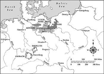
Map 1. The Electorate of Brandenburg at the time of its acquisition by the Hohenzollerns in 1415
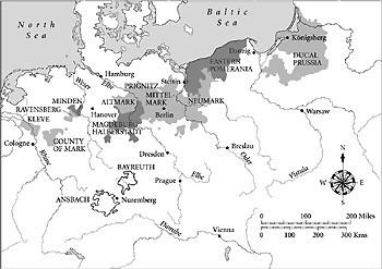
Map 2. Brandenburg–Prussia at the time of the Great Elector (1640–88)
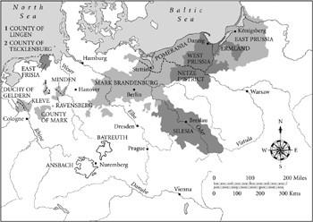
Map 3. The Kingdom of Prussia at the time of Frederick the Great (1740–86)
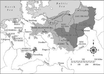
Map 4. Prussia during the reign of Frederick William II, showing the territories taken during the second and third partitions of Poland
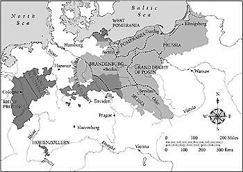
Map 5. Prussia following the Congress of Vienna (1815)
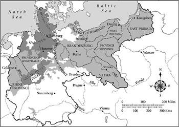
Map 6. Prussia at the time of the Kaiserreich 1871–1918