
Area Eight
HISTORICAL SECTION
Arromanches had been selected as a site for one of two artificial harbours to be built by the Allies in the early days of the Normandy landings. It was realised that any invasion could only succeed with the availability of port facilities so that supplies, equipment, ammunition along with more men and vehicles could be brought in. None of the beaches where the landings would take place had such facilities, and those at Arromanches itself, along with Courseulles, Ouistreham and Port-en-Bessin, were too small. Cherbourg was the nearest major port to the west and Le Havre to the east, but it would potentially be many weeks or months before these would be reached and there was no guarantee they would be captured intact. The solution was to take port facilities in following the initial landings, build a port in-situ and supply the armies ashore from there.
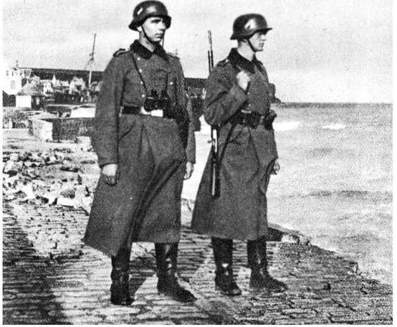
German guards overlooking the seafront at Arromanches, 1943.
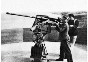
AA gun at the German gun battery on the high ground above Arromanches.
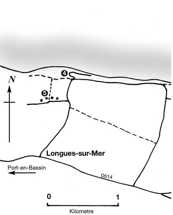
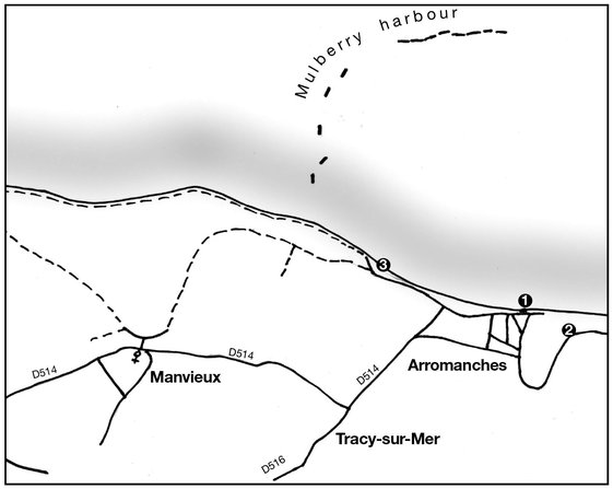
Arromanches Walk
1. Arromanches Museum
2. 360 Cinema
3. Viewpoint
4. Observation bunker
5. Longues Battery
The idea for an artificial harbour can be largely traced back to Winston Churchill who had first muted the proposal in the First World War, and from May 1942 the plan began to formulate in memorandums to the Combined Commanders planning the return to the European mainland. Churchill stressed that some design of pier would be needed on any landing area, which must be able to withstand bad weather and float up and down with the tide. He concluded to the planners, ‘Don’t argue the matter. The difficulties will argue for themselves.’1 It was another year before the idea was discussed again and once it was accepted, as little as eight months remained until the actual landings would take place.
The proposed harbour facilities would be made up of a number of features. On all the landing beaches redundant ships known as ‘Corncobs’ would be brought over, lined up and sunk forming a breakwater where light shipping could then unload supplies via smaller craft and DUKWs onto the beach. These were the ‘Gooseberries’ and it was planned to have all fine running by D+5. Two of the Gooseberries – at GOLD and OMAHA beaches – would then be expanded into a complete artificial harbour, each to be on a similar scale to Dover harbour in the UK. Extra breakwaters would be made by bringing in concrete caissons known as ‘Phoenix’ sections. These were huge hollow concrete vessels which could be floated over, taps turned on inside allowing the seawater in and then secured to the seabed with rubble; when it was decided rubble would be needed one officer came up with the idea of using rubble from Blitzed London – the concept being that the enemy may have destroyed buildings in our capital city but that rubble would then be used against them in the invasion of Europe.
A section of the Mulberry harbour being constructed in London’s docks.

Each harbour would have two entrances and within have berthing facilities for deep-water ships, besides berths for everything from landing craft to tugs. Inside the safety of the Corncobs and Phoenixes small craft could then move around in all weathers transporting material from ship to shore. To assist in rapid unloading piers – ‘Whales’ – would be constructed with the floating roadways suggested by Churchill. Although they would be secured to the seabed, the engineering was developed in time to make them able to move up and down with the swell. Having these roadways meant that large numbers of tanks and vehicles could be quickly unloaded and sent inland. Outside the port for ships of especially large size, ‘Bombardons’ – large floating steel structures – would be placed allowing stores to be unloaded and brought into the harbour or onto the beach. Collectively, all these elements made up ‘Mulberry’, the name given to the harbour and there would be a Mulberry A at OMAHA Beach and Mulberry B at Arromanches, west of GOLD.

A Phoenix section.
Pontoon section of the Mulberry harbour.

The D-Day plan was that all these elements would be in the Channel on the day of the landings and once the areas where the Mulberry harbours were going to be built were secure, the block ships would move in, the Phoenix sections sunk and the piers and other facilities put in place. Thus, on 6 June the vessels bringing everything that was needed patiently waited for events on the land to unfold. And while the landings went well that morning, before anything could be constructed on the British sector first Arromanches had to be taken. This was tasked to the men of the 1st Bn Hampshire Regiment. This unit had landed in the first wave on GOLD Beach and taken heavy casualties getting off the beach, including their commanding officer. Major Warren, one of the company commanders, had taken over and held an Orders Group with his remaining officers at a captured radar station east of Arromanches. His plan was simple, to hit the town from the rear while the Germans within were under fire. Warren called in naval gunfire from a destroyer, plus the self-propelled 25-pounders from 147th Field Regiment. D Company would make the assault, and B and C were to lay down covering fire from the high ground above the town. The battle was highly successful. D Company cleared the town against only slight resistance and twenty prisoners were taken at no loss to the Hampshires. By 2100 Arromanches was liberated; for the Hampshires D-Day had gone from tragedy to success.
With the town now in Allied hands it was hoped that work on the Mulberry could begin. However, just to the west of Arromanches was a substantial German gun battery located close to the village of Longues-sur-Mer. This had survived the pre-D-Day bombardment and was still potentially active on D-Day. It, therefore, had to be neutralised before the construction of the artificial harbour could begin, otherwise it would be in a position to fire on it. This battery site consisted of four 152mm naval guns in casemates made from 600m3 of concrete to protect them from bombardments. None of the tons of bombs or Allied naval shells had affected the capability of the battery and on D-Day it had fired on both OMAHA and GOLD beaches. No British units were in reach of it by the close of D-Day, but on 7 June the 2nd Bn Devonshire Regiment, commanded by Lieutenant Colonel C.A.R. Neville, was called up to assault the position. They had landed on GOLD the day before and taken the village of Ryes, where they had dug in for the night. On the 7th they attacked Longues encountering no opposition from the garrison, capturing all the casemates and a large number of prisoners without any loss. They remained here until the next day when the course of battle took them to Port-en-Bessin.
Work finally began on Mulberry B late on D-Day as the Gooseberries were brought in. Next day explosives put in the sea and sunk on an even keel, Phoenix sections were put in place, rubble unloaded and work on the piers and Bombardons began. This work was completed by the Port Construction Companies of the Royal Engineers, who were able to open the first pier in the east (known as the ‘LST Pier’) by 14 June. Just two days later the breakwaters were half complete, two piers were now in operation but the roadways were not running as envisaged as bad weather had sunk five tows of Whale roadways and two Phoenix sections. On the following day the weather got progressively worse, building up to a major storm in the early hours of 19 June.
A raging gale on a lee shore is a seaman’s nightmare. Ships and craft crowded into the shelter of the Gooseberry breakwaters and the Mulberry harbours but there was not enough room for them all. As huge waves broke in the shallow water off the land, ground tackle of heavier landing craft did not always hold and numbers were driven ashore; there, pounded by the surf, many broke their backs or were badly damaged. Rhino ferries were swept high up the beaches, reducing to matchwood small craft in their path. The shuttle service from England was suspended but craft which had already left for France when the storm arose arrived in the assault area to add to the congestion and increase the number that met with disaster.... When at last, on June the 22nd, the storm abated the whole invasion coast was strewn with wreckage. About eight hundred craft of all types were stranded, most of them heavily damaged and many entirely destroyed; on some beaches wrecked craft were piled on one another in dreadful confusion.2

Aerial view of the Mulberry harbour.

The sheer size of the Mulberry harbour is evident.
Roadway section allowing tanks and vehicles to drive onto the shore.


One of the main piers.
Docking facilities for hospital ships were also an important part of the harbour.

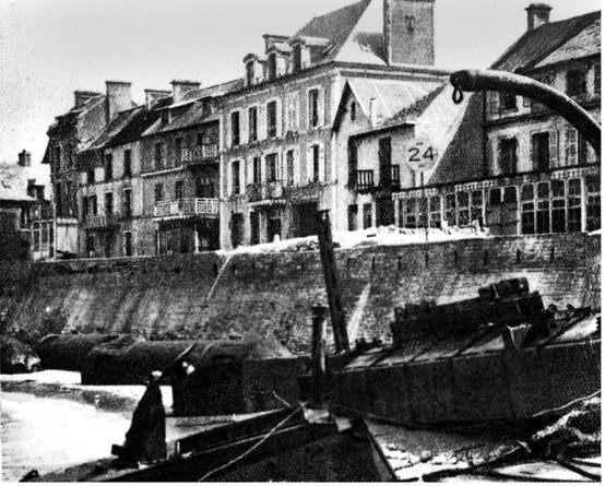
After the storm the beach was strewn with debris.
At Arromanches the harbour had been damaged but generally had withstood the storm well; its shelter had saved many vital ships within. But at OMAHA Beach the weather had been at its worse and the placing of the breakwaters different than at Arromanches. Here Mulberry A was completely destroyed, so much so that all that could be done with the wreckage was to use it to repair the damage to Mulberry B at Arromanches. From a wider point of view, the storm had not only delayed the arrival of supplies, but also men at a vital point in operations. Up to 18 June on the British sector, for example, the daily average of men arriving had exceeded 15,700 men per day. Between 19 and 23 June this dropped to under 4,000, with the tonnage in stores dropping from 10,666 to 4,286 per day.
Mulberry B was gradually repaired and remained in British use until the autumn of 1944. As the Allied advance took the British Liberation Army out of the Normandy bridgehead into France, then Belgium and finally Holland, the line of supply still stretched all the way from Mulberry to wherever the British were fighting, which by the late summer was well over a hundred miles away. Cherbourg had been taken and found so damaged by the Germans it was unusable; the same was true at Le Havre. It was not until Antwerp was finally taken and re-opened as a port that the use of Mulberry gradually reduced, but it never properly closed and the amazing artificial port remained in use until VE Day.

Allied personnel remained in the harbour until the end of the war. Here in 1945 supplies were still being brought ashore by landing craft.
Walk 8: At Arromanches
STARTING POINT: Car park, Arromanches Museum
GPS: 49°20′24.7″N, 0°37′16.0″W
DURATION: 14.1km/8.77 miles
This walks gives the walker a good idea of the size and scope of the Mulberry harbour, and can be extended to take a pleasant and picturesque coastal walk over to the Longues Battery, one of the best preserved German gun batteries in Normandy where the guns are still in place.
Start in the car park of the Arromanches museum. This museum (www.musee-arromanches.fr) tells the story of the Mulberry harbour and has a unique model of it, made in the 1950s by a British railway modelling company. It is an excellent way to start this walk. From the museum walk into Rue du Six Juin 1944 and go left, going straight across at the next junction and follow the route uphill. For now ignore the memorials you see as these will be visited later in the walk. Just past a Sherman tank follow the track ahead up onto the cliff tops above the town. Here there are superb views over where the Mulberry harbour was located and the remaining sections of it are clearly visible. There is also a viewing platform here, and a memorial to the Royal Engineers, who did such important work in the building and maintenance of the harbour. Close by is the Arromanches 360 Cinema (www.arromanches360.com); this is unique in Normandy and is a 360-degree film about the Battle of Normandy and well worth a visit.

On the first anniversary of D-Day a ceremony was held on the beach at Arromanches.
A section of the original roadway is now on display in Arromanches as a memorial to the Mulberry harbour.
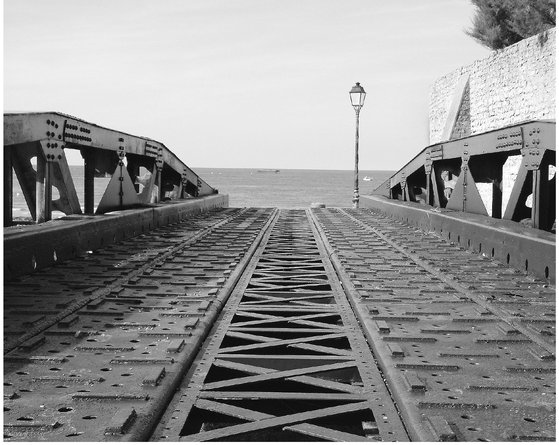
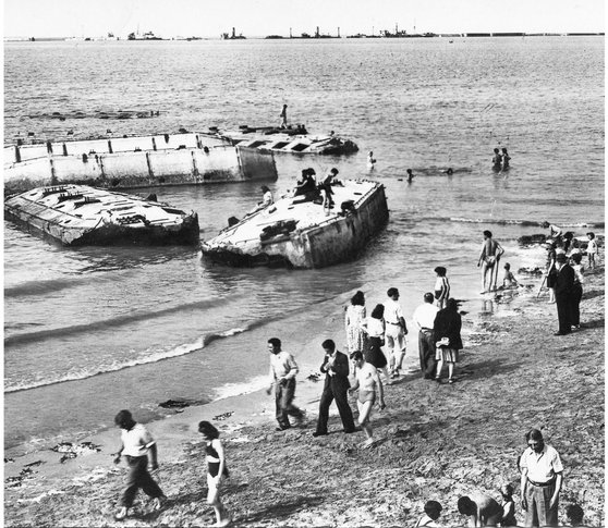
Sections of the harbour became tourist attractions as early as 1946.

Sections of the harbour remain on the beach today.
At low tide it is possible to walk out to some of the Phoenix sections close to Asnelles.

From the cinema follow the path downhill and then right into Rue Charles Laurent and to the car park where the Sherman tank is located. This M4 Sherman was given to the town as a permanent memorial to the fighting here in 1944. Retrace your route back down towards the town but just before the museum turn right and immediately stop. There is a roadway section of the Mulberry harbour on display here and a memorial to Major Alan Beckitt, the ‘architect of Mulberry harbour’. From here continue; you can go down onto the beach if it is low tide and walk below the sea wall, or walk along the sea wall keeping the town on your left. Either way, you will get a good view of the remains of the harbour and if on the beach be able to walk up to some of the sections here. If on the beach, continue to the next ramp, and on the sea wall continue past the next ramp and follow the path on the sea wall to the jetty. Here go left and walk to a crossroads; here go right onto Rue des Freres Victor.
The fire-control bunker at the Longues Battery.
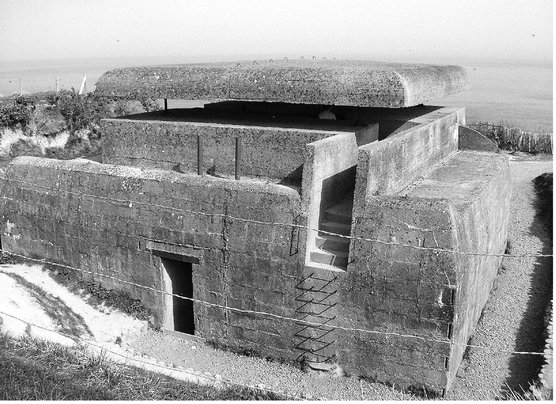
Stay on this route uphill. Further up there is a German bunker on the right, and again there are good views of the Mulberry remains from this route. The road ends a coastal path then appears on the right. Follow this path for the next few miles as it weaves its way along the cliff tops, taking care not to walk too close to the edge. Eventually, this path meets a minor road. Take this road and follow it running parallel to the cliffs; eventually it reaches the site of the Longues Battery.
Following this route you start at the Observation Bunker that was the eyes of the battery. If you have seen The Longest Day it will be familiar as the site was used as a location in that production. The bunker can be fully explored and then a path followed to the four gun casemates that retain their original firepower. There is also a small visitors’ centre/shop here with toilets. From the car park at the shop follow the D104 towards Longues but before reaching the village take the first left down a minor unmarked road. Follow this across the fields to a crossroads of tracks and go left back towards the cliffs, then take the second right. Go down this minor road to the village of Manvieux and go left onto Rue de l’Eglise. Stay on this until it becomes Rue La Perruque and follow it back towards the cliffs. At a fork in the track go right and stay on this back down into Arromanches. In the town follow the main road back into the centre and the car park at Arromanches museum.
Unique in Normandy, the main casemates still have their original armament.
