20
AUGUST 2012
FIVE HOURS INTO the C-130 flight, we crowd against the windows to watch the sunset over the southern tip of Greenland. Jagged, gray-black mountains rise at the coastline, and beyond them the white shag carpet of the ice cap stretches to the horizon. No settlements are visible, no signs that anyone has ever set foot there. From twenty-seven thousand feet, it looks like the proverbial last place on earth. Bil Thuma asks, “Can you imagine being an airman who goes down out there and says to himself, ‘It’s OK, we’re going to get out of here’?”
Lou asks me to walk with him to the rear of the cargo bay. Over the thrumming noise of the engines, he tells me that he’s annoyed that Jim Blow has only now told him about the new Coast Guard–funded airborne radar survey by the U.S. Army Cold Regions Research and Engineering Laboratory, or CRREL. Lou’s also frustrated that CRREL didn’t use a device called an airborne magnetometer that he says might have detected metal from the Duck’s engine under the glacier.
“We’re supposed to be working together,” Lou says. “If he had told me, I would have said what we need isn’t more radar, it’s a magnetometer.”
“OK, but it’s done. Let it go,” I say. “Lou, the new radar gives us more places to search, and the results gave Jim the confidence to convince his superiors to go ahead with this mission. You’re on the same side.”
“A little communication would be nice,” Lou says. “Teamwork, right?”
I stop by Jim’s seat, and he hands me the new radar report, complete with maps showing the directional flow of the glacier and the locations described as “strongly prospective targets.” Later, when I tell him that Lou would have preferred an airborne magnetometer, Jim reminds me that Lou had been working for months trying to get a private company to run just such a survey. Jim says he expected Lou to be successful on that score, so he focused on getting the Coast Guard and CRREL to provide new radar results, in the hope that the complementary studies would pinpoint search sites two different ways. When Lou’s discussions with the airborne magnetometer company fell through, Jim says, he went ahead with the radar because he wanted fresh data.
He has a point: before the results of the CRREL study, most of the radar results were four years old, from what was known as the Essex overflight of 2008. The glacier, and with it the Duck, might have moved since then.
“I think Lou felt left in the dark,” I say.
“That wasn’t the goal,” Jim says. “These results increase our chance of success.”
I walk away thinking that Lou and Jim are equally invested in this mission, and also that they aren’t seeing eye to eye. More important, I sense that the dustup over the new radar is a harbinger of clashes to come. The pressure they both face to succeed, their different natures, and their conflicting organizational cultures make disputes almost inevitable. If they don’t trust one another, or at least communicate effectively, the mission will suffer and the Duck Hunt won’t fly.
By default, I have a new role. As the one mission member not formally attached to North South Polar or the Coast Guard team, I hold passports to both. And since I’m on good terms with both Jim and Lou, I can be an honest broker and cultural interpreter. That is, as long as neither shoots the messenger.
WE CAN’T FLY directly to Kulusuk, Greenland, because there’s no way to refuel the C-130 at the small airport there. So after midnight local time, we touch down in Keflavík, Iceland, where we’ll spend the rest of this night and one more. Even in Iceland, the expedition shopping spree continues. After worrying for days about the crevasse fields, Lou decides that we need an aluminum extension ladder to use as a portable bridge to span deep cracks in the glacier. He sends Alberto Behar to a local hardware store to buy one, then sends Frank Marley to buy another. We’ll have to strap them to the skids of a helicopter to get them to Koge Bay. But other than buying propane, gasoline, and diesel fuel in Kulusuk, we’re finally ready.
Before we leave Iceland, Lou and Jim gather everyone in a hotel meeting room to recount the history of the November 1942 crashes and the mission operations plan. Lou explains that first we’ll use global positioning system (GPS) receivers to place marker flags at the six most promising search coordinates, known as points of interest, or POIs. Three of the POIs were spotted during 2008 and are known as Essex One, Essex Two, and Essex Three, the last of which appears to be close to where Balchen placed the X on his treasure map. It’s also the most heavily crevassed area we’ll be searching. The three other top-priority points of interest come from the new CRREL report, and are known as points A, B, and K. After the six points are marked with GPS, Jaana and the safety team will use the ground-penetrating radar to see if anything that looks like a Duck lies beneath the ice. If not, we’ll move on to two more CRREL locations, known as points N and O. If those come up empty, too, it’s not certain what we’ll do. If there’s time, maybe we’ll investigate a couple of historic coordinates. If none of those locations reveals the Duck, we’ll have to accept defeat and go home.
The next day we fly a little more than an hour to the Kulusuk Airport, where the C-130 kicks up plumes of dust as it touches down on the gravel runway. Mountains and dormant volcanoes dominate the treeless landscape that surrounds the tiny airstrip. Even in August patches of snow crown the nearby slopes.
Seventy miles south of the Arctic Circle, Kulusuk passes for a sizable settlement on the east coast of Greenland, with a general store, a school, about three hundred residents, and twice as many sled dogs. From the air, the fishing village is picturesque, a cluster of homes painted red, blue, or gray, clinging to rocks overlooking a small harbor where stray icebergs take up temporary residence like visiting tall ships. But the impression changes after a mile-long walk from the airport into town, along a winding dirt road that passes two small cemeteries filled with plain white crosses. Up close, most houses are weather-beaten and need repair. The constant threat of frozen pipes means that most have no running water, so the people of Kulusuk, most of them Inuit, haul water from a pumping station and rely on outhouses or chemical toilets. With residents isolated by ice and snow for most of the year, and with little local economy to speak of, dependency on alcohol and welfare is common.
It’s a big day in Kulusuk when we arrive, as rifle-toting hunters in small motorboats have brought back two killer whales. The black-and-white whale carcasses are hoisted onto the town’s small concrete dock, where an audience gathers as they’re butchered, the meat distributed freely among the townspeople. When the townspeople leave, plastic bags with phonebook-sized slices of blubber are left behind, and the whales’ severed heads are visible for days in shallow water alongside the bloodstained dock.
The C-130’s Coast Guard crew is eager to take off, so they quickly disgorge our gear. Lou climbs onto a giant yellow front-loader as though he’s General Patton atop a tank. He hangs onto its side-view mirror to direct its driver as he arranges four tons of equipment, including twenty-five huge Pelican cases, more than a dozen smaller Pelican cases, two Hotsy pressure washers, several ice drills, a five-foot-cube water tank, generators, mounds of duffel bags, and two aluminum extension ladders destined for helicopter airlift to Koge Bay.
THE FOUR-PASSENGER AIR Greenland helicopter lifts off from Kulusuk Airport crammed with five of us aboard: me; Jim Blow; Coast Guard public affairs specialist Jetta Disco; logistics manager Steve Katz; and logbook keeper and aide-de-camp Ryan Sapienza. The Swedish pilot follows the coastline south, occasionally veering from his flight path to show us a two-hundred-foot waterfall at the edge of a cliff, or icebergs shaped like a medieval castle or a slice of cake bigger than a city block. Flying at five hundred feet, then diving toward the water, he circles twice over a bay to point out what looks like a whirlpool of boiling water. Closer inspection reveals that it’s a killer whale chasing fish in a feeding frenzy. An hour into the flight, we turn east toward the coastal mountains, flying straight toward the rocky slopes only to pull up and over at what feels like the last possible second. Soon we’re cruising over crevasse-covered glaciers toward the North South Polar–U.S. Coast Guard’s Duck Hunt 2012 base camp.
We land on the ice forty yards from the campsite, much of it already set up by team members who arrived on earlier helicopter flights. The chosen spot is a cul-de-sac tucked against a rock outcropping called a nunatak that overlooks Koge Bay. The rock serves as a windbreak, and the site is no more than one and a half miles from the farthest point we plan to search. Laid out before us on a barren, gently sloped, ice-covered field are a half-dozen orange-and-gray sleeping tents, their stake loops held down by rocks gathered from the nunatak. During the next hour, in temperatures hovering around the freezing mark, we’ll erect four more sleeping tents to complete our temporary village. Duffel bags, spools of rope, gasoline cans, and half-empty Pelican cases sit in clusters on the edge of the ice field.
Fifty feet from the sleeping tents, at the base of the ridge, is one of two green mini-barn tents, this one filled with mountaineering gear and two Pelican cases. The tent will serve as the command center, and the cases will double as desks to spread out maps to plan each day’s assault on the glacier. Atop a rock ledge twenty feet past the mini-barn is the big dome tent, a zippered flap open to reveal several team members drinking coffee, their faces glowing orange from the sunlight through the nylon. On the same ledge, a few feet away, is the second mini-barn tent, filled with food, cooking equipment, and the tireless Michelle Brinsko, getting an early start on lunch. Later, when the beans in her chili refuse to soften, she’ll declare that they’re a special Icelandic legume called Bierdorff Beans that are supposed to be crunchy. No one who wants to eat another meal dares question Michelle’s dubious claim. Her failure-is-not-an-option mandate remains unblemished.
On the other side of the big dome is a fifty-foot-diameter meltwater pond that becomes a reflecting pool at dusk for the setting sun. At first we pump pond water for drinking and cooking, but soon WeeGee Smith and “Doc” Harman drill a hole behind camp that fills with water flowing from inside the glacier. They rig up a pressurized, gravity-fed system that supplies us with water so fresh we could bottle and sell it as Koge Bay Glacier Melt.
On the other side of the rocks is the gray outhouse tent, complete with a small orange flag whose position inside or outside indicates whether it’s occupied. “Planting the flag” becomes the camp euphemism for a toilet trip. Lou chooses the highest point of the nunatak overlooking the camp for the real flagpole, where he flies the American flag and the “Honor and Remember” mission banner with the names of the three men we hope to find.
Visible in the distance to the west, beyond the nunatak and across the Koge Bay fjord, is the sharply rising glacier where the PN9E crashed. Now more than ever, I understand what pilot Armand Monteverde encountered when he steered the big bomber from the end of the fjord over the glacier, only to have the ice rise up to meet him. Seventy years later, the glacier where the B-17 crew awaited rescue remains laced with crevasses. The fjord is jammed with icebergs calved from the glacier’s two-hundred-foot-tall leading edge. The thunder of new icebergs being born echoes through base camp.

A VIEW OF THE DUCK HUNT CAMPSITE FROM THE NUNATAK OVERLOOKING THE TENTS. (MITCHELL ZUCKOFF PHOTOGRAPH.)
The weather forecast is clear and mild for the workweek ahead, with temperatures in the teens at night and the high forties during the day. Best of all, there’s no sign of polar bears, rendering the shotgun and rifle wise but unnecessary precautions. The Snublebluss warning system that Lou ordered from England never arrived, so the absence of bears is especially good news. I compliment Frank Marley on how smoothly the camp setup has gone, but he’s not impressed. “Camping is the easy part,” Frank says. “That’s not what we’re here for.”
DURING THE PAST few months, Jim Blow has grown intrigued by the X on Bernt Balchen’s 1943 hand-drawn map. Our base camp is less than a mile from Blow’s best estimate of the site of Balchen’s “X.” The exact location can’t be known because Balchen didn’t include coordinates, and his ink and watercolor drawings captured some, but not all, of the coastline and the rock ridges that rise from the glacier. The sketches also simplify the Koge Bay area by omitting perhaps sixteen miles of glacier-covered land between the X and Comanche Bay, a geographic flaw that long raised questions about the map’s accuracy.
To gain a better perspective, Jim, Lieutenant Commander Rob Tucker, and I climb to the top of the rocks at the edge of camp. We imagine the flight path John Pritchard might have taken in the Duck from the PN9E over Koge Bay to the spot on Balchen’s map. It’s at once easy and chilling to envision the little biplane rising from the bomber’s crash site and sweeping over the glacier, then turning toward Comanche Bay, into whiteout conditions that would render an ice-covered hill an invisible and deadly obstacle. Jim’s mind remains fixed on Balchen’s map.
“Absent a photograph of the actual crash site,” he says, “that is the best piece of data that we have because it was drawn by an eyewitness. The more study we’ve done of the charts and the satellite images of this area, the more that Balchen’s ‘X’ basically is our greatest point for re-creating what happened that fateful day. Based on that and what we know about the ice movement, and the lay of the terrain now, Balchen’s ‘X’ has a lot more credibility as we’re out here.”
Jim has an explanation for the maps’ missing swath of land. “Now I’m thinking he omitted that on purpose, because that’s a lot of detail that didn’t need to be in there. He was just trying to show where the aircraft was.”
Later, Jim and I hike a half mile to the end of the nunatak to look over the crevasse field that contains the Essex Three/Balchen X sites. Returning to his pilot roots, Jim balances on the rocks and imagines how John Pritchard might have ended up there. “He’s coming down the fjord, he’s calling for magnetic orientation, trying to get a bearing to the ship.” Jim points to a rock outcropping at the edge of the water. “I would estimate that he would see this upper cliff, and as soon as he thought he was clear, he’s going to turn to the bearing that the ship gives him, which I assume that he has heard.”
Jim pulls out his iPhone and uses a digital compass to find the direction to Comanche Bay. The compass bearing from where we stand is 115 degrees true, or exactly the course the Northland tried to give Pritchard. “At 115 degrees,” Jim continues, “he would turn and be going in that direction, which is into that ridge”—a snow-covered hill several hundred feet high—“which he would not be able to discern. I’m just curious, if he hits here, bearing 115 into this ridge, where would he be on this slope seventy years later?” Jim is equally pleased that the area fits witness descriptions that the crash site was an open field sloping half a mile to the water.
The possible value of Balchen’s X is one subject on which Jim and Lou agree. Lou has been telling me for months that the Essex Three point of interest aligns with Balchen’s X and holds special allure for him. Yet both men know that the under-ice anomaly spotted by airborne radar at Essex Three might be nothing more than a crevasse or pooled water atop bedrock. Also, even if Balchen was correct in 1943, the glacier’s movement might have carried the Duck’s wreckage a half mile or more, to the vicinity of Essex One, Essex Two, or the new CRREL target points A, B, and K.
The bottom line is that unless Jaana’s ground-penetrating, boots-on-the-ice radar reveals a powerful image of an anomaly roughly the size of a crushed Duck, all the planning and speculation in the world won’t matter.
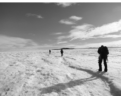
ALMOST FROM THE moment she stepped off the helicopter, Jaana has been linked by a rope umbilical cord to safety team members, most frequently John Bradley and Frank Marley. Their first task has been to use a handheld GPS receiver that John brought with him to translate the mission plan’s points of interest from latitude and longitude coordinates to actual places on the glacier. When the coordinates on John’s GPS match those of a POI, the team plants an orange flag at the spot, as a reference point for when they return with Jaana’s radar to sweep the area.
When safety team member Nick Bratton joins the flag-placement teams, the size and conditions of the Koge Bay glacier worry him. He writes in his journal, “My first foray onto the ice was a cautious one. I’ve spent lots of time on lots of big glaciers, but this was on a different scale altogether. Words cannot describe how incredibly enormous this glacier was. From our camp the ice stretched to the north and west as far as the eye could see.” Nick is troubled that our campsite is in a transition zone, an unpredictable place where snow is in the midst of becoming glacial ice. He recounts his first survey trek to his journal: “Most crevasses were visible but filled with snow, so the depth and strength of the snow bridges were unknown. As for the unseen crevasses, who knows how many there were? Those are always the real danger. You rarely fall into a crevasse you can see. The hidden ones are what get you.”
After flagging the first few points of interest, Jaana begins her radar work in earnest during her second day on the glacier, Friday, August 24. First on her list are Essex One, Essex Two, and Point K, which is between those two Essex points. Dragging the dragon-tail antenna behind her, she clomps back and forth over each site, watching the screen on a control unit that hangs from a harness at her waist. If she notices any anomalies, she can circle back for another look. The control unit also records the radar readings and location coordinates for analysis back at base camp.
Jaana explains that the radar takes a cone-shaped view of the glacier down to the bedrock, more than a hundred feet below. Any interruption in the solid ice appears on the screen as shapes called hyperbolas, which to the untrained eye resemble flatter versions of McDonald’s golden arches. One problem is that crevasses create hyperbolas similar to ones made by, say, the wreckage of an amphibious World War II Coast Guard biplane. Jaana’s expertise enables her to distinguish between a crack and a Duck.
As she scans the first points of interest, Jaana adjusts her route to avoid surface crevasses, but she and her safety minders try to walk in lines as straight as possible over the crunchy snow, to create overlapping cones of radar and to create a complete image of what lies beneath each point of interest.
Anticipation rises when Jaana, Frank, and John return to base camp for lunch. Inside the dome, Jaana transfers the data to her laptop computer, but nothing on her screen from the first three points of interest looks like an airplane. These were among the most promising sites, and the bad news spreads. Disappointed expedition members wander in and out of the dome, hoping that Jaana finds something unexpected during her closer look. When she doesn’t, Lou is deflated. “I feel like walking out there and seeing where the Duck might have flown into the glacier,” he says. “I want to appeal to the spirits of Pritchard, Bottoms, and Howarth, to ask that they help us find them.”
Nick’s concerns about safety grow when he sees Jaana’s data. Under what appears to be solid stretches of glacier ice, the radar shows fractures deep and not-so-deep beneath our feet. “Shit like that worries me,” Nick tells his journal. “There is no way to mitigate that. Walk fast.”
As lunch ends, whispers race through camp that there’s a problem with our GPS receivers, which means that the flag placements for the points of interest are in the wrong places. On one hand, the good news is that if Jaana repeats the radar survey in the right locations, she might get better results. But a bigger worry emerges: if the GPS receivers don’t work, we can’t know where the flags properly belong. A mistaken GPS reading that places a point of interest flag as little as thirty yards from its correct location might be enough to ruin the search. In that case, Jaana might as well take a drunkard’s walk across the glacier, randomly taking radar readings. That approach would have about the same chance of success as shooting an arrow into the air blindfolded and expecting it to pierce an apple on Lou’s head.
JOHN BRADLEY LEADS THE RADAR TEAM ONTO THE GLACIER, FOLLOWED BY JAANA GUSTAFSSON, WITH THE GROUND-PENETRATING RADAR DEVICE, AND FRANK MARLEY. (MITCHELL ZUCKOFF PHOTOGRAPH.)
Tensions rise as word of the GPS problem spreads. Jim fumes that we’ve been relying on small personal GPS devices, yet two highly accurate Trimble-brand GPS receivers sit idle in the dome tent. “We’re talking about mission-critical technology, and no one knows how to operate the Trimbles,” Jim says.
Lou says he thought that Jaana or Bil would know how to use the Trimbles, but it turns out neither does. At the moment, we’re forced to rely on unreliable personal GPS units. For instance, John Bradley’s GPS unit places Essex Two on a rocky slope instead of where everyone agrees it belongs, in a wide-open area of the glacier.
The GPS issue compounds Jim’s irritation that no one from North South Polar knows how to operate a metal-detecting magnetometer that Lou brought. The magnetometer job falls to Terri Lisman, the geophysicist from the National Geospatial-Intelligence Agency, who’s part of the Coast Guard team. Terri gamely reads the manual and assembles the unit. She follows Jaana to the erroneous points of interest and, not surprisingly, detects no metal under the ice.
I find Lou near the kitchen tent to be sure he’s aware of Jim’s exasperation. He says he’s already on top of the issue. “If we don’t have GPS,” Lou says, “we’ve got nothin’.” He asks Alberto Behar to apply his PhD in electrical engineering to the task of figuring out the Trimble units. Lou considers this par for the course on such a complex mission. “It’s easy to point fingers and blame. The crew of the PN9E could have done the same thing. But they had to survive, and we have to succeed. They worked together. I wish Jim had come up to me and said, ‘Lou, how do we work together to fix this?’ ”
Although Lou is the mission’s civilian leader, frustration among the North South Polar and Coast Guard team members congeals around Steve Katz, Lou’s second-in-command, whose job is to direct personnel and keep the mission on track. Privately, expedition workers complain that Steve seems unfamiliar with the mission plan, issues confusing and sometimes contradictory orders, and appears unsure how to address the GPS crisis. For his part, Steve says his army experience has taught him to expect grousing from the ranks when things get rough.
Yet soon I can’t walk more than a few feet without someone pulling me aside to criticize Steve’s leadership and preparedness. I wonder if team members’ widespread doubts are by themselves evidence that Steve is outside his element and is losing control of the troops. Still, he seems untroubled, and later he relaxes alone on the nunatak, smoking a cigar.
As frustration deepens over the inaccurate GPS readings, nerves get frayed, patience wears thin, and an old word gets a new meaning. In its original use, an icehole is a shaft that WeeGee melts into the glacier using the Hotsy. Or, more accurately, it’s a shaft that he would melt if we knew where to search. As hours slip past with little progress, icehole is repurposed as a term of disparagement, used to describe anyone seen as not carrying his or her weight or doing his or her job. As in, “He’s being an icehole.” The phrase gets a workout.
After lunch, Jim and Steve hike up the glacier toward Essex One and Essex Two to visually compare the flags’ GPS-dictated locations with the points as they appear on the mission map. While they’re out, Bil Thuma calculates the distance between base camp and the flags’ proper locations, to determine how far off the GPS-determined placements might be. By nightfall, when Bil’s calculations are complete and everyone is back in camp, the expedition’s leaders reach a dismaying conclusion: the flag placements are up to several hundred yards from where they belong. Worse, with two days gone and less than five days remaining, no one knows how to fix the problem.
I pass WeeGee on the way to my sleeping tent.
“So, Mitch,” he asks, “how does it end?”