The events of the first day’s fighting can be described with some confidence and without too many inconsistencies. It is in describing the events of the second day’s fighting, the climax of the battle, that difficulties occur. My description of the battle, which follows, places it on the Dryfield of Balquhiderock, but opinion is divided on this and many favour the Carse of Balquhiderock as the site. Deciding between these two possible sites is difficult because of the changes to the landscape that have been wrought over the centuries. There was undoubtedly more woodland in 1314. Bogs and marshes were then far more extensive and the Carse of Balquhiderock was certainly not the well-drained almost manicured farmland that we see today.
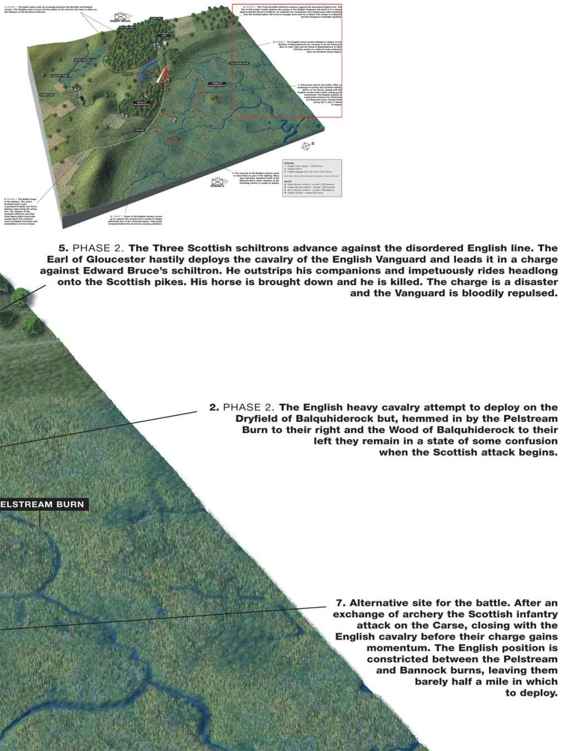
We know from Sir Thomas Grey that, ‘The English columns … were jammed together and could not operate against them [the Scots].’ Lanercost says something similar: ‘The English in the rear could not reach the Scots because the leading division was in the way.’ This state of affairs must have been because the nature of the ground restricted and hemmed in the English, so they were unable to deploy their superior numbers or bring their archers into action. The topography of both the Dryfield and the Carse of Balquhiderock can be made to fit the situation.
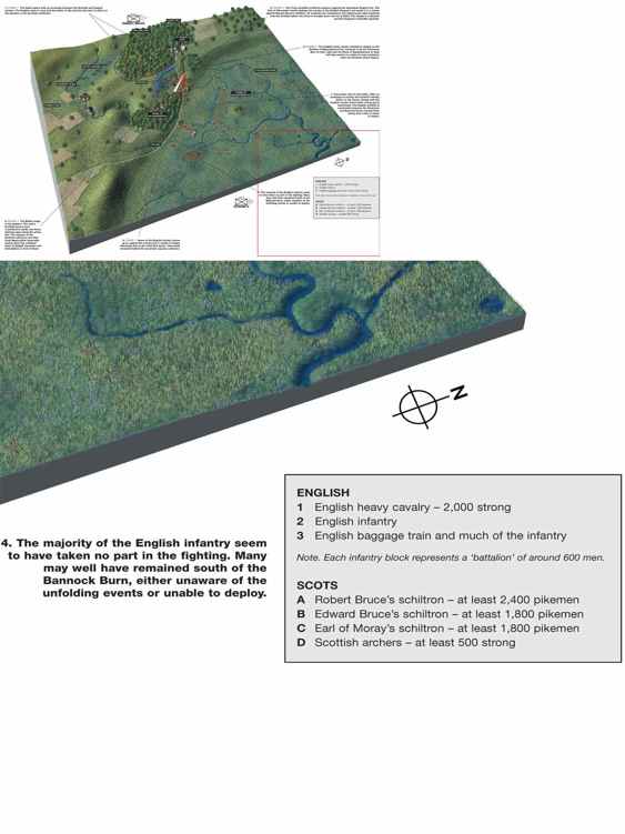
On the carse, the Bannock Burn and the Pelstream Burn have to be the restricting features, at their nearest approach they are about half a mile apart. The Pelstream Burn, however, may not run its original course on the carse and any associated bogs and marshland that once existed have been drained, so there is no more than a rather unconvincing stream to be seen today.
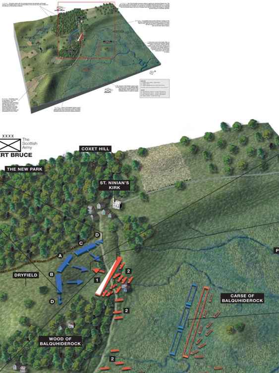
On the alternative Dryfield site, the Pelstream burn crosses the Dryfield in a deep, steep-sided channel that even today in parts retains enough of its former cover of trees and entangled undergrowth to suggest that it would have prevented the passage of formed bodies of troops in 1314. This forms the northern extremity of the Dryfield battle site. To the south the Wood of Balquhiderock, though reduced from its former extent, still covers the steep escarpment and forms an obstacle to progress between the carse and the Dryfield between the point where the Bannock Burn disgorges on to the carse and the settlement of Broomridge. Between Broomridge and the Pelstream Burn the contours widen enough to allow easy access to the Dryfield, and it is this gap through which the English heavy cavalry made their way on 24 June to form up on a line north-west to south-east, facing the New Park. The former extent of the Wood of Balquhiderock on the Dryfield is not clear but we must assume that it was more extensive than today and served to restrict the width of the battlefield to the south.
THE SCOTTISH ATTACK
Monday 24 June 1314, early morning, viewed from the southeast. After a brief and inconclusive archery duel, the Scots attack the English cavalry who are forming up on the Dryfield. The Earl of Gloucester leads the cavalry of the English vanguard in an impetuous, and disastrous, charge against Edward Bruce’s schiltron. The Scottish pikemen close on the disorganised English line and a bloody mêlée develops.
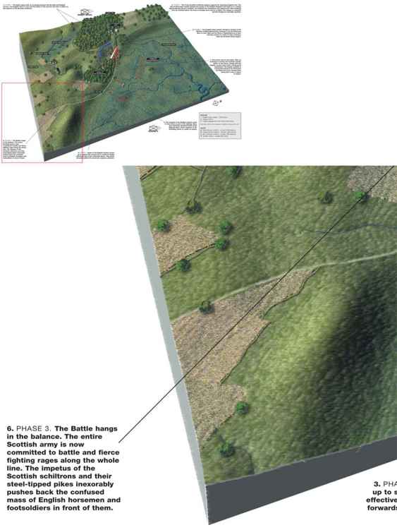
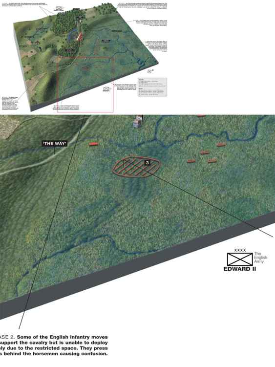
If this was the case then the English may have been pushed back from the Dryfield into a narrowing funnel formed by the Wood of Balquhiderock and the Pelstream Burn, which resulted in their being increasingly bunched together into a constricted mass. From this followed defeat and flight via the carse to their rear along which they could escape either north, towards Stirling Castle, or in the direction of the River Forth or back over the Bannock Burn. This fits in nicely with what we know about the flight of the English from the battlefield. Yet the uncertainty surrounding the defining features of the landscape in the early fourteenth century leaves the site of the battle still tantalisingly elusive. Despite the continuing urbanisation of the Dryfield site, a visit is interesting and worthwhile. It is still possible to walk over the area, the features mentioned are still there, and with a little imagination readers can form their own opinions on the site of the battle.