CHAPTER SEVEN
First of all, your own transport is a must, there is no real public transport in the area that will go anywhere near the rural areas in which the battles took place. To get to this part of Europe it is best to drive. There are the airports in Brussels, Luxembourg and Cologne, but it would mean hiring a car from there.
From the ferry port of Ostende, take the main motorway number E40 and head for Brugge, Gent, Brussels, Liège. After Liège the signs will start indicating Aachen and Germany.
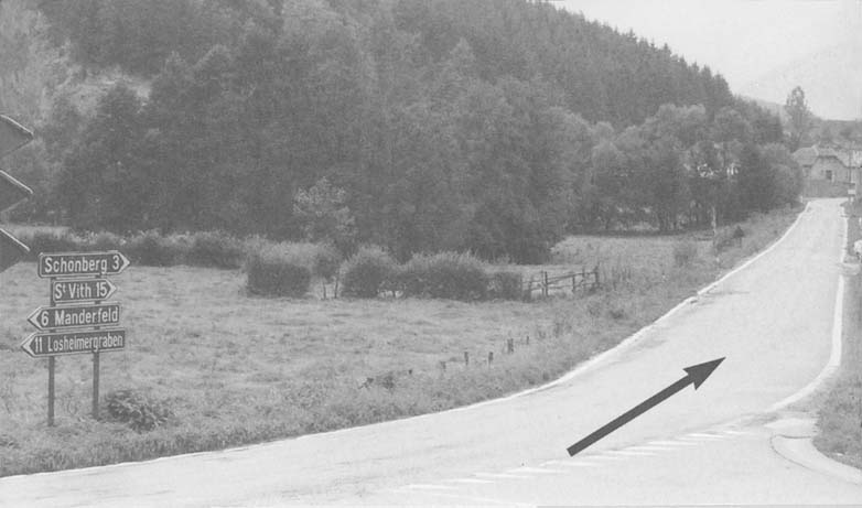
Turn right onto the E42, marked Verviers, Spa, eventually St Vith will be reached. Or, carry straight on looking out for a sign for Bleialf. You are now in the thick of it, as they say. There are many hotels and guest houses in the larger towns of St Vith and Prum, both within easy reach of the battlefields. Or, you can stay in any of the numerous ‘Gasthaus’ or smaller hotels scattered around the area. All villages have at least one. These are good value for money. Both St Vith and Prum have railway stations, the line to Bleialf is now closed.
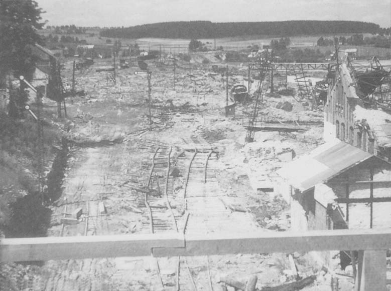
St Vith Railway Station in 1945.
Roads in the area are marked L: (Landes) = Country, K (Kreis) = County and B (Bundes) = National.
The people are very friendly on both sides of the border, each village no matter how small, seems to have a bar. Quite a pleasing site after scrambling around the rugged terrain. Just look for the ‘Bit Burger’ signs, an excellent local brew.
Most of the villages have been rebuilt since the war. The locals have a knack of blending the new with the old, so that it is difficult to distinguish between the two.
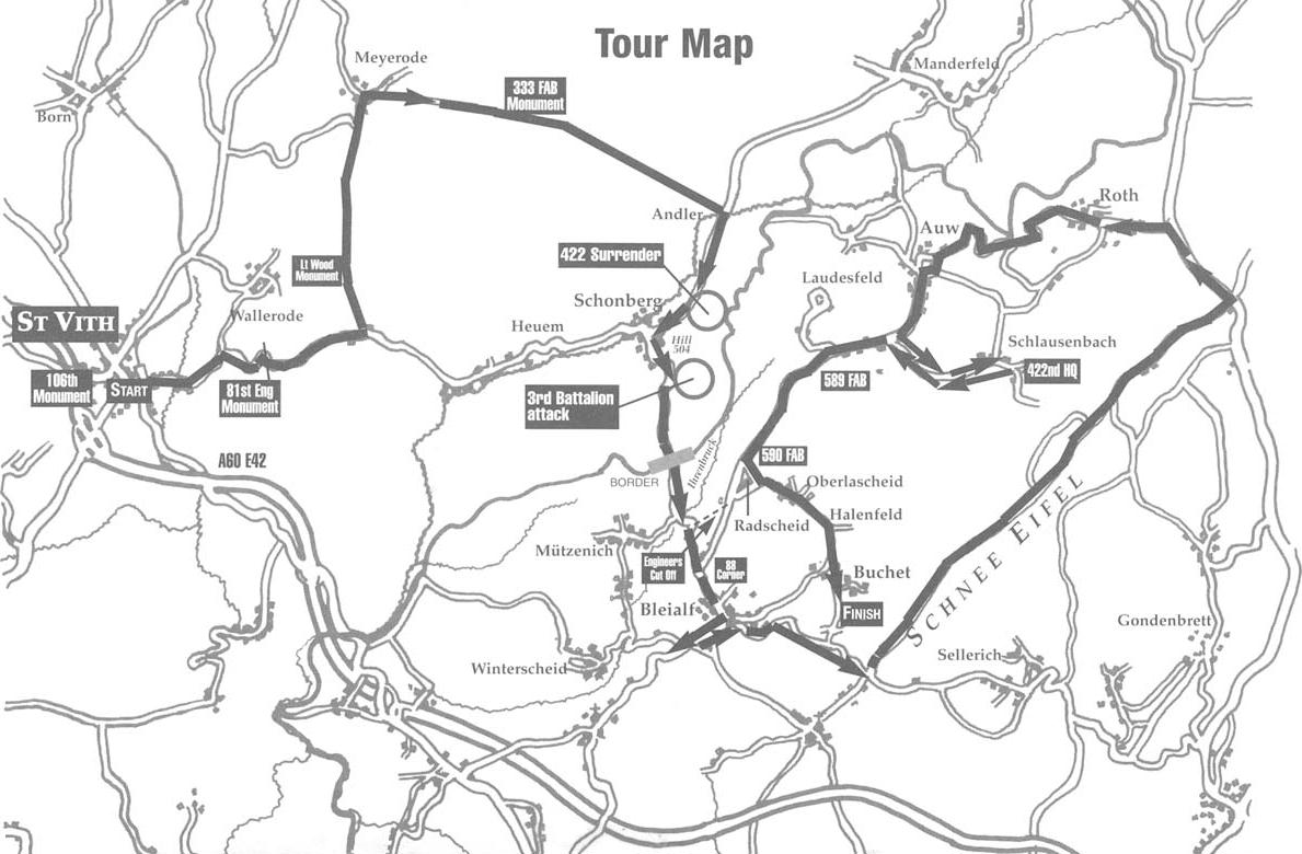
St Vith
The town was virtually flattened in December 1944, little now exists of the original town buildings, although the road lay-out still remains the same. As can be seen by the map drawn by a member of the 2nd Infantry Division on the 15/11/44, we can take it that, because the 106th relieved the 2nd, man for man, the various headquarters, motor pools etc would have been in the same positions, only the code words would have changed.
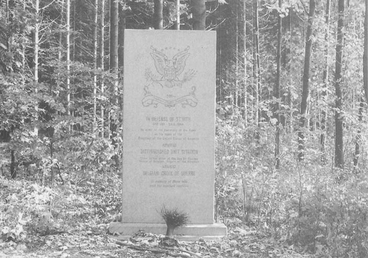
Approaching the centre of town from the north, a large crossroads will be found with a roundabout. Proceed straight across into Klosterstrasse and about a quarter of a mile on the right can be seen a monument dedicated to the 106th Infantry Division. This monument was erected by the 106th Infantry Division Association and is cared for by the people of St Vith. The building behind the flags was the original memorial which was built in the mid 50’s. It is now being used by the school. In mid 1995 a new memorial was erected in front of the old. The large rock comes from the local region, and is special to that area. A brass plate on the stone has an inscription to the men of the 106th and says, ‘Dedicated to the Men of the 106th Infantry Division who fought and died for their country 1944–45.’
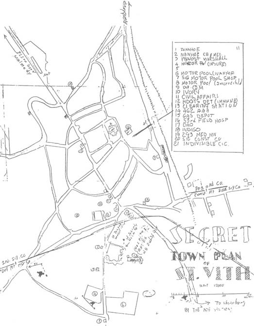
Map of St Vith drawn 15 November 1944. The 106th Infantry Division took over position for position.
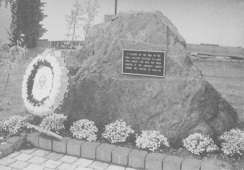
Monument to the 106th Infantry Division in St Vith.
This was the sight of Divisional Headquarters.
Come back to the crossroads and turn right on to the N26. On leaving St Vith the road twists and starts to climb into the forest. This area is the Prumerberg heights, scene of the desperate defence by Colonel Riggs and his Engineers. There is a memorial on the left at the top of the heights to the men of the Engineers. You can park by the side of the road and walk into the woods, either left or right, much evidence can be seen of the fighting that took place here between the 17 – 21 December.
A word of warning here. Munitions are still lying about and are very dangerous, be careful what you pick-up. Digging or metal detecting is not encouraged, in fact it is forbidden. If in doubt about anything lying around, DO NOT TOUCH. This goes for the entire battleground. Rejoin your car.
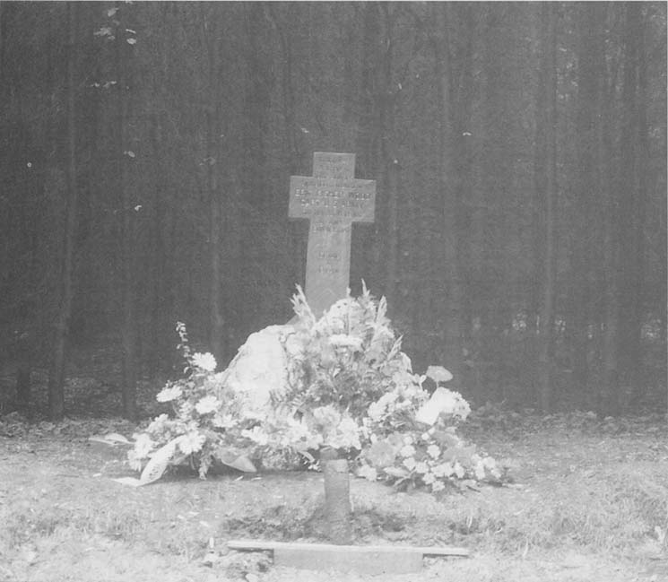
Moving along the Schonberg road towards Heuern (81st Combat Engineers HQ) look out for a decorative wrought iron works on the right, immediately opposite there is a small road north, on the left hand side. This road leads through the dense forest, eventually conning out at the village of Meyerode. About 500 yards up this road is a small monument on the left, tucked into the trees. It is a simple, inscribed cross, the monument was erected by the people of Meyerode in honour of Lieutenant Eric Fisher Wood of the 589th Field Artillery Battalion. His body was found nearby. He is now buried in the American War Cemetery at Henri Chapelle.
If you stay on this small road and get to Meyerode, there in the village outside the school is a German 75mm anti-tank gun. Opposite the school is a bar, this was once Dietrich’s Headquarters for a time. You can get back on track by turning right in the village, and heading towards Wereth and Herresbach. Just after Wereth, on the left at the edge of a field is a newly erected monument, this was erected in honour of the eleven black soldiers of the 333rd Field Artillery Battalion, a Corps artillery battalion attached to the 106th, who were murdered by the SS. Carry on to Andler. In Andler there is the inevitable bar, Gasthaus Kessler. In this building was housed Company A, 331st Medical Battalion, serving the 422nd Infantry Regiment and the 14th Cavalry, it was used as their Aid Station. Opposite, there used to be a dance hall, owned by Herr Kessler, captured American Officers were brought for interrogation. The famous photographs and propaganda German newsreel film of American prisoners being marched away was filmed alongside the River Our in this vicinity.
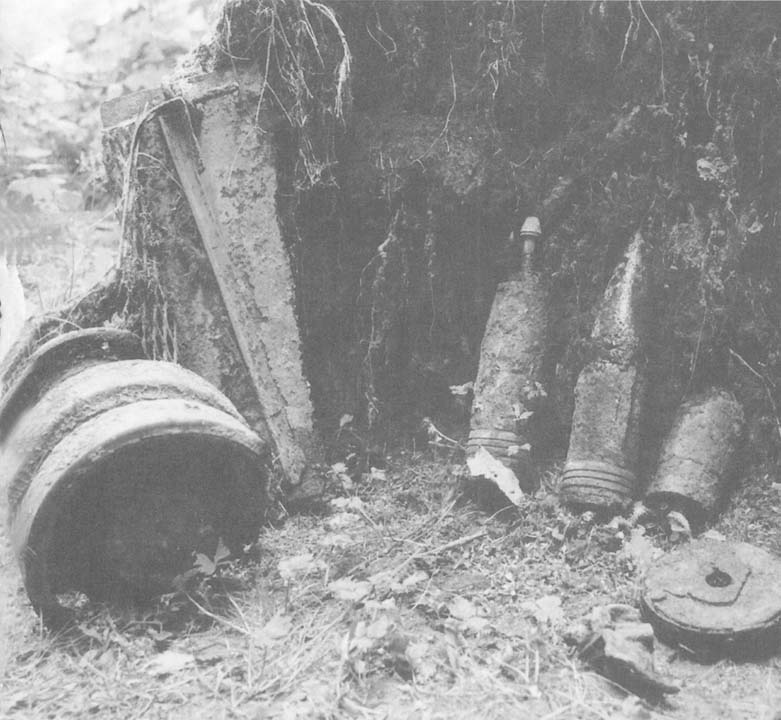
Shells, bits of half-track found at the base of Lindscheid Hill.
From Andler proceed back down the N26 towards Schonberg. About half a mile on the left is another small road which forks off the N26. If you look up the open slope to the top of the hill, you will see where the 422nd Infantry came out of the woods and saw below them (where you are) vehicles ‘bumper to bumper’, the occupants of which then proceeded to open fire on them. You can drive or walk up this fork road, which will lead you to the spot where the remnants of the 422nd surrendered. It is in the area where the road ends and leads into a track passing through the woods.
Into Schonberg, this is another place that has been rebuilt, even the bridge across the Our River is in a slightly different location. Turn left in Schonberg and the road starts to climb steeply. The large hill on the left, covered in trees, is the famous Hill 504. Where the road (N595) does a large left hand loop there is a lay-by on the right.
Looking up the road, there is a logging trail up on the left. Down that trail came men from Klinck’s 3rd Battalion, Company L and met the American Sherman tank manned by Germans. Heavy fighting took place on this spot. Both sides of the road were littered with German and American dead. The 3rd Battalion, what was left of it, was pulled back up the trail to the top. It was here that Cavender joined them and finally gave the order for the 423rd to surrender.
There is still much to see on the top of the hill, numerous foxholes and shell craters. But once again, please be careful as there is still a lot of live ammunition kicking about.
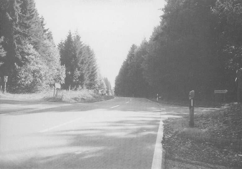
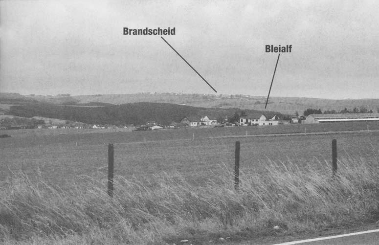
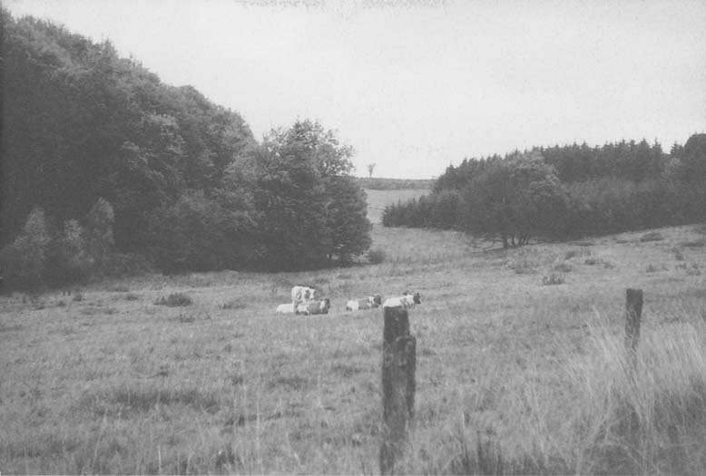
Proceed south, all the woods on the left were held by the 106th, and attached VIII Corps Artillery units, you do not have to walk far anywhere along this road to find the evidence. Large pits dug into the ground, which once were the emplacements for artillery pieces such as 155mm and 8 inch howitzers. The place is littered with the clover leaf shaped trays that once were containers for shells and powder charges, and the lifting eyes for the shells are in abundance everywhere. As you come out of the woods there is a turning right that leads to Amelscheid, immediately opposite this in the open field, was the final position of the 589th Field Artillery Battalion, before it drove ‘hell for leather’ through Schonberg and some of it onto St Vith. Also, it was on this part of the road that the unsuspecting German Volkswagen fell into line with the convoy of M8 armoured cars, and was consequently shot to bits. Midway down the hill, you will pass from Belgium into Germany; there is a small (usually unmanned) customs post on your right. At the bottom is the hamlet of Ihrenbruck. Just before the large old custom house on the right, is a patch of woods, here was stationed Service Battery of the 589th FAB. Follow the road across the bridge of the Ihrenbach stream – it starts to climb again. At the very sharp bend half way up the hill is a trail on the left. This was cut through the woods and became the entrance to ‘Engineers Cut-Off’. Remains of the couduroy road can still be seen in places. Continue on the main road, follow it to the top of the hill where it comes out on a curve. This area is called Justenschlag. But to the GIs, it was named ‘88 Corner’ or ‘Purple Heart Corner’. Left is ‘Skyline Drive’, right and down the hill is Bleialf. As you can imagine, any movement in this vicinity, could easily be observed from the German positions in and around Brandscheid, far on the horizon directly south. The high wooded mass south and to the left of Brandscheid is the Schnee Eifel.
Proceed down the hill into the town of Bleialf.
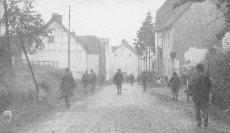
Village of Bleialf where the heaviest fighting in the St Vith sector took place – then and now.

Here there are still some original old buildings dotted about, but, as with the rest of the area, it took its share of destruction. In the centre is the Church, it was around this, that there was particularly vicious fighting those first few days. When the local priest emerged after the initial battle bodies were strewn everywhere, both American and German. After the mass surrender the majority of American prisoners spent their first night in the ground of this Church, before being marched off deeper into Germany. The famous American author Kurt Vonnegut was one such prisoner that passed through here. Later as a prisoner of war he witnessed the destruction of Dresden by Allied bombers. This later went on to inspire him to write the classic novel Slaughterhouse Five. Ernest Hemingway also was here. He had a meal in the cafe/bar opposite (Cafe Zwicker). But this was slightly earlier, when the American 4th Division initially captured Bleialf. He was with Officers, members of this Division, his favourite, whom he tagged along with. Apparently he spent the entire time complaining because of the noise from a field artillery battalion firing from dug-in positions behind the bar. In the town are a couple of small, but well stocked supermarkets, plus an excellent bakery and butchers. A small tip, because of the rural nature of the area, very very few people speak English, so if you don’t ‘sprechen Deutsch’ take a good phrase book with you. Also there, is a petrol station, where somebody will serve you, chat about the weather and give the kids a sweet whilst they fill you up.
Drive south-west out of town for about one mile and you will see what used to be Bleialf railway station. It is now a private house. Viewing south from this point, you will see where the main effort of the German attack came from, in their final onslaught to take Bleialf on 17 December. If you follow this road it will take you into the area of the other 106th Division regiment the 424th. Come back into Bleialf and pass the Church on your left, follow the road out and round until you come to a cross roads at the foot of the Schnee Eifel. By the side of the road is a bus shelter with a small parking area. This area was being held by Company A, 423rd Infantry, on the morning of 16 December. Stand in front of the shelter and look forward into the forest; you are viewing the area held by Company B. The road that goes right leads to Brandscheid, a village held at that time by the Germans. It became known as ‘Little Verdun’, because it was captured and retaken so many times during the conflict. It was a difficult place to take, owing to the many fortifications, for it was an intregal part of the West Wall or Siegfried Line.
Straight on will take you to Sellerich and eventually Prum.
Schnee Eifel. Company B, 423rd Infantry Regiment positions were in the woods to the right.
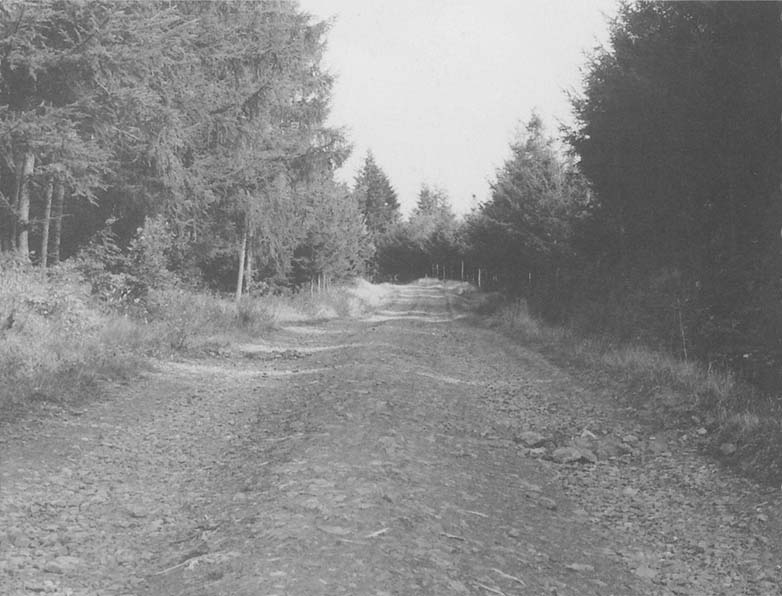
This was the way the 18th Volksgrenadier Division came in their attack on the southerly pincer move around the Schnee Eifel. Left is signposted Schwarzer Mann, or as the Americans called it, ‘Bogeyman Hill’. This is the start of the famed Schnee Eifel. Unless you visit the area in the depth of winter when there is two or three foot of snow on the ground and the temperature is well below freezing you cannot start to imagine how much the men suffered. Now all is calm, the stately fir trees give welcome shade from the sun, but even now, standing alone next to a front line foxhole, starts the mind racing on how it must have been. In the centre of the ridge is the Schwarzer Mann, the highest spot around. There is a bar/restaurant there, and in the winter the area is used for snow sports. This spot just about marks the boundary between the 422nd and the 423rd. Bunkers are abundant left and right of the road. This main tarmac road was not there during the war, but the unimproved trail to the left was then the main access. Hence the bunker line alongside of it. The majority of these bunkers, not destroyed during the conflict, were finally blown by the French in 1949.
The actual front-line foxholes of the infantrymen, are in the woods to the right of the road, about 300 to 400 yards on the forward slope. Many are still in evidence. Great care must be taken when parking, not to block the trails, these are not in constant use, but farmers or loggers have a nasty habit of creeping up on you and get fed up if they cannot get by. During summer, needless to say, everywhere dries out, so fire is a big risk. Smoking in the forest is ‘Verboten’. There is nothing dangerous lurking, apart from the odd wild boar, who can turn funny if disturbed or upset.
On reaching the end of the Schnee Eifel, turn left on the B265 and travel for a short distance, turn left again and head for the villages of Roth and Auw. This is the southern end of the Losheim Gap. Many German units came this way during the attack. In Auw turn left again by the Church. This spot was where the Germans started nosing up the hill towards the 589th FAB. This road was called ‘Skyline Drive’ or ‘Skyline Boulevard’ by the Americans. Proceed up this road, first left will take you to Schlausenbach; Descheneaux of the 422nd had his headquarters in the Inn here. You cannot go any further by car. Walking the many tracks will take you back up to the Schnee Eifel.
Retrace your steps and come back up to ‘Skyline Drive’, turn left. About one hundred yards was where the 589th FAB had its outpost on 16 December. Drive into the tiny hamlet of Herzfenn; the 589th FAB were based in and around here. Battery B and C were to the right and just inside the tree line, Battery A was to the left and on the edge of a patch of woods just under half a mile away. See location map of 589th FAB for more details. Turning right immediately at the far end of the hamlet, will take you to the village of Laudesfeld where the 592nd FAB with its 155mm howitzers was emplaced. Just south-west of Laudesfeld a high hill will be observed, in this area on 19 December, approximately 500 men from all different units made a perimeter defence, and held on until finally surrendering on the morning of 21 December, 1944.
The next hamlet along ‘Skyline Drive’ is Radscheid. Here the 590th Field Artillery Battalion were in position, with Its firing batteries in the woods on the left of the road. Leaving the car here, by two solitary buildings one of which was the 590th headquarters, you can walk to the right, down a farm track, passing open fields, and into the woods. This track was used by the 423rd Regiment and 590th FAB on their way to attack Schonberg. At the end of the track another will be found running parallel to the Ihrenbach stream, turn right and follow the track until you come across a clearing. Across the stream is a small wooden bridge. The 423rd Infantry crossed here, on its way to Hill 504.
View from Skyline Drive looking south.
The aid station was in scrub undergrowth just across the stream. This whole area was jammed with vehicles from the regiment, unable to cross the boggy ground. Also here, was the 590th FAB which had only just set-up. The Germans overran this position at about 0930 on 19 December. It was here that we found 105mm ammunition in evidence and numerous hastily dug foxholes, ammunition boxes etc.
Cross the stream and head off up the hill. The 1st and 2nd Battalions were here behind Hill 536 at daybreak on 19 December. It is where Cavender gave the orders to attack Schonberg and was immediately hit by an artillery bombardment. Moving on will eventually bring you to Hill 504. It’s quite a walk!
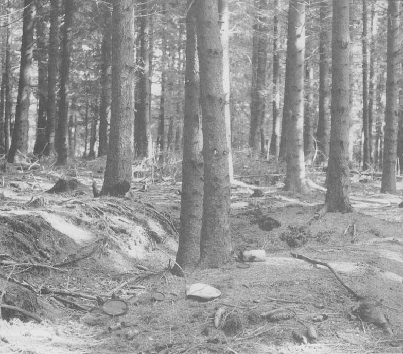
Foxholes and debris of battle on Hill 504. Typical of the sort of rusting artifacts to be discovered throughout the area of the Battle of the Bulge.
Return to ‘Skyline Drive’, turn left into the village of Radscheid, Oberlascheid, Halenfeld and Buchet, where Cavender had his headquarters. Continuing through, you will come back out onto the main road between Bleialf and the Schnee Eifel. Turn right for Bleialf. It is possible to stop alongside any forest area in the region, and only after a short walk into the woods find evidence of fighting. This is because the area was fought over for quite a long time, and many units passed through during the conflict from September 1944 to the beginning of February 1945.
There are two really good museums that are worth a visit but are about an hour’s drive away. One is at La Gleize, the furthest point Kampfgruppe Peiper reached in the attack. Outside the museum is one of his Tiger II tanks left there after the Germans retreated. The other museum is at La Roche-en-Ardenne, dedicated to the Battle of the Bulge. In Vielsam, there is a Sherman tank in memory of the 7th Armored Division, and at Baraque Fraiture, also known as Parkers Crossroads, where Major Arthur C Parker III, along with remnants of Battery A 589th FAB and other units, set up their three remaining howitzers and made a roadblock. They were successful in holding up the 2nd SS Panzer Division and 560th Volksgrenadiers Division long enough to enable the 82nd Airborne to get into position. They were eventually overrun. To mark the spot there is a memorial with a 105mm Howitzer in position.
At Spineux (Wanne), in the centre of the village there is a monument dedicated to the men of the 424th Infantry Regiment of the 106th Infantry Division and also to the men of the 112th Regiment of the 28th Infantry Division. These two regiments survived the initial onslaught in December, and joined together to form a Combat Team which went on to push the Germans back. They subsequently liberated this local area in January 1945.
Enjoy your break or holiday in this part of the Ardennes, the scenery is breath-taking. Be prepared to do a lot of walking over rough terrain, so dress accordingly.
Above all try and cast your mind back to that terrible December in 1944 and give your respect to those brave soldiers of both sides.
Some further good reading on the subject:
A Time for Trumpets by Charles B MacDonald
St Vith, Lion in the Way by Colonel R Ernest Dupuy, reprinted by The Battery Press, INC,
1986
The Official Divisional History Last Assault by Charles Whiting, Leo Cooper, 1994
Healing the Child Warrior by Richard W Peterson Ph.d (A member of the 106th Division) U.S. Army in World War II The Ardennes, Battle of the Bulge by Hugh M. Cole, Deputy
Theater Historian, European Theater of Operations, U.S. Army
Monument to the Combat Engineers on the Prumerberg Heights.
Memorial to Lieutenant Eric Fisher Wood (see page 85)

The view John Kline had of Schonberg from his 30 cal machine gun position.

Men of the 3rd Battalion 423rd Infantry Regiment came down the track onto the road on their ill-fated attack on Schonberg.

Company L, 3rd Battalion, 423rd Infantry Regiment, came onto the Schonberg road at this point and met the captured Sherman tank, which opened fire on them (see page 108).
The logging trail used by 3rd Battalion 423rd Infantry Regiment.
It was in this area by the Ihrenbach Stream that vehicles of 423rd Infantry Regiment and the 590th Field Artillery Battalion finally ended up.

Hastily dug foxholes and the remains of a 50 calibre ammunition box near the Ihrenbach Stream.
Andler-Schonberg Road, viewed from Andler. It was down this stretch of road that the right-hand pincer arm of the 18th Volksgrenadier Regiment advanced on the 17th December.
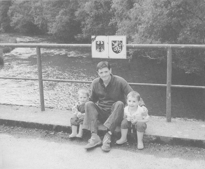
The author, Michael Tolhurst, with his two sons Stuart and Stevie in 1992 on the border bridge over the River Our, which marks the boundary between Belgium and Germany.