CHAPTER THREE
OVERLORD planners had sought information from all available sources on such matters as water depths, beach contours, gradients, tidal patterns, and coastal obstructions such as reefs, soft sand patches, or sandbars. Beyond the beaches the terrain was further assessed for its suitability as a defensible lodgment, as a logistic base for subsequent operations, for the siting of improvised air landing grounds, and for avenues of approach inland for the breakout.
This detailed analysis drew on all sources of information including pre-war holiday postcards and family snapshots gathered from a willing public throughout Britain. Special Forces personnel, in addition to air, navy and army intelligence assets also conducted active military reconnaissance operations. The secret army of local French Resistance operatives also provided timely information. On display in the Museum of Peace in Caen, are examples of their intricate hand-drawn sketches and maps made by these French patriots in Normandy throughout 1943-44. The precision and detail of such intricate work is breathtaking.
From bases in England, electronic surveillance systems also monitored all the intercepted radio emissions from occupied Europe. Radar sites command headquarters and unit locations were detected, identified and integrated into the vast intelligence mosaic that would ultimately shape the Allies plans for the great counter-invasion in the West. The most notable source of signal intelligence came from the Ultra intercepts. As Group Captain Desmond Young a veteran of 123 Wing in 2nd ATF wrote in his memoir Typhoon Pilot, ‘The preparations were staggering...The scale and precision of it all made our past efforts look insignificant.’
The coast in 1st Corps sector consisted of flat sandy beaches with rocky outcrops above the low water mark along the whole sector except for two short stretches at the mouth of the Rivers Seulles and Orne. It was also assessed that there were clay patches that would hamper beach movement for vehicles in the western half of the sector. The beaches were generally backed-up by sand dunes. Sea walls or even low cliffs provided additional obstacles to vehicle movement. Inland of the dunes, the ground to this day rises to about 200 feet in a rolling expanse of cultivated farmland.
On the right (western flank) of the 1st Corps area, the River Seulles and its tributaries (including the Thue and Chiromme) formed obstacles to movement by wheeled if not tracked vehicles. On the left (eastern flank), the Caen Canal and river Orne formed major north-south obstacles to all lateral movement. The water level in the former was controlled by lock gates in Ouistreham and by a barrage in Caen. The lock gates were defended by bunker positions with armoured cupolas. Beyond the Orne to the East, thickly wooded, dominant high ground divides the valley of the River Orne from the valley of the river Dives.
In 1944 the Germans frequently made a five to fifteen mile zone, from the seashore inland, off-limits though fishermen and farmers were usually allowed to maintain their trades. Within Sword sector the town of Ouistreham dominated the coastline. Going west along the assault beach, the smaller holiday settlements at Hermanville and Lion sur Mer provided navigational reference points to the boat crews and fortifiable strongpoints to the German defenders. Behind this narrow coastal crust of settlements, the ground rises gently towards Cresserons, Periers Ridge and Colleville. That dominant curve of higher ground offers superb views of the Channel, the coastline and the far bank of the Orne. Not surprisingly, German strongpoints around Colleville were sited there on dominant features. Behind the Periers Ridge and to the south towards Caen, the ground becomes more complex with a series of valleys and ridges interspersed with villages connected by narrow roads. Just north of Caen the ground rises to what was formerly the thickly wooded Lebisey Ridge. The ridge then falls away into the city of Caen.
With a few exceptions the OVERLORD lodgment area was not suitable for heavy military traffic. So the unfortunate assault troops would be committed to moving inland into the traditional Norman countryside known as bocage. Bocage denotes high hedges grown on earthen embankments to separate fields, crops and ownership. These high earthworks and the overhanging tree canopy and foliage often overshadowed roads and tracks. In 1944 the bocage would be a godsend to the defender and a nightmare to the attacker. Today, few examples remain in the British sector as fields have been expanded and roads widened. Good examples of bocage can still be seen in the Suisse Normande around Falaise and behind Omaha and Utah Beaches.
German Defences in Normandy
In May 1944 a signal from the Japanese naval attaché in Berlin to Tokyo was intercepted by British intelligence and decoded. It confirmed that Rommel intended to destroy any invasion ‘near the coast, most of all on the beaches.’ To that end Rommel had designed an overall defensive scheme for the Normandy sector consisting of three belts. The first belt was sited on or immediately behind the beaches and consisted of a narrow band of obstacles covered by fire from coastal defense units. A second line consisting of strongpoints up to five miles inland was under construction. By June 1944 this second line was still incomplete. At Sword Beach, however, strongpoint Hillman (located inland from La Breche D’Hermanville) dominated the back-beach area and was very much complete.

Beach defences along the invasion coast were being improved daily.
So while a rigorous battle could be fought at the water’s edge and in the backbeach zone, should any penetration be made beyond this fortified area, the thin belt of initially strong positions along the coast and in the deep draws would became inherently vulnerable to being rolled-up from the flank. This threat could only be countered by local mobile reserves able to mount immediate and effective counter attacks. Should these initial lines of resistance be penetrated then Rommel would have to call upon his third line of defense, the operational reserves, which could initially fix and then destroy any Allied breakthrough.
To reinforce the foreshore defences, the Germans were seen to be building new obstacles along the Norman coast by February 1944, under the direction of Rommel. The 3rd British Infantry Division’s ‘Briefing Intelligence Summary’ described the defences they would be facing at Sword Beach, however the general assessment was applicable to all the beaches. It stated:
‘Defence activity has quickened since February on the occupied coasts, following a tour of inspection in January by ROMMEL, who is anti-invasion Army Group Commander. The principal new features are under-water obstacles, the provision of overhead cover for field and medium artillery, an intensification of minelaying, and a tendency to dig field defences on commanding ground 2,000-4,000 yards inland.’
The Beach obstacles were sited in three bands and designed to impede or defeat landing operations between the high and low water marks across the tidal flat. The outer obstacle strip consisted of reinforced iron structures known as ‘Element C.’ These gate-like structures stood ten feet high and had Teller anti-tank mines lashed to their upright supports. The Element C obstacles were sited about 250 meters below the high water line. The second line of obstacles were sited a further 25 metres toward the beach. This belt consisted of mine, or shell, tipped wooden posts, each one foot thick, driven into the sand at a shallow angle and supported by an ‘A’ frame. These ramp type obstacles were usually sited in two rows between thirty to sixty feet apart with about fifty feet between individual obstacles. The angle was such that these obstacles would present a major threat to the hull of any approaching vessel as the tide covered the line of eught to ten foot high posts between one and two hours before high tide. On D-Day this particular line of obstacles would prove to be a formidable barrier to landing craft.
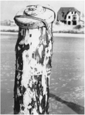
Tellermines were attached to the tops of wooden stakes.
The final lines of submerged barriers were sited one hundred and thirty yards from the shore. These consisted of steel ‘hedgehogs’ constructed from three or more angled steel girders crossed at their centres. Each hedgehog stood approximately five foot high and was sited in rows about 100-110 meters long, each row containing fourteen to seventeen hedgehogs at twenty foot intervals. Rows were overlapped and ran continuously across the beachfront and were submerged about an hour before high water. Intelligence assessments stated that these obstacles could sink in the sand. These hedgehogs were sufficiently strong that they could penetrate the hulls of landing craft. It is important to realize that these belts of obstacles were not continuous but were staggered to hamper the direct approach of craft to the beach. On 6 May General Eisenhower described these beach obstacles as ‘one of the worst problems of these days.’ Two days later, a full assessment had been made of up to date photo-reconnaissance pictures. These high-resolution pictures had allowed the positions of each obstacle to be plotted in detail. As a result of this intelligence, the Allies confirmed that the landings would commence at half-flood on the day that this came at forty minutes after nautical twilight (June 5 was ideal with possible postponements acceptable to the 6 or 7 June).
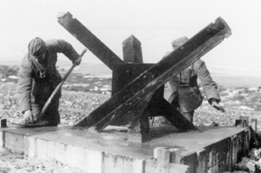
Three girders bolted together at the centre, and set in concrete blocks, were intended to cause landing craft to be concentrated into zones that were covered by the defenders’ guns.
At Sword Beach the Germans had not placed loose mines on the tidal flats but sited them above and beyond the beach and around the beachfront villas. A barbed wire triple concertina obstacle belt had also been integrated into the landward defences immediately above the sands. In addition, the Germans had made full use of all available weapons including captured French and British mines from 1940. They also built a number of marked and fenced dummy minefields with pieces of metal plate buried to deceive mine detectors and so prolong and delay any clearance of the area by combat engineers.
Mines were being laid in ever increasing numbers leading up to D-Day.
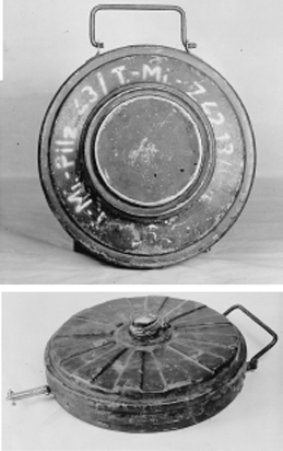
Right: Tellermine 43 and below right Tellermine 35.
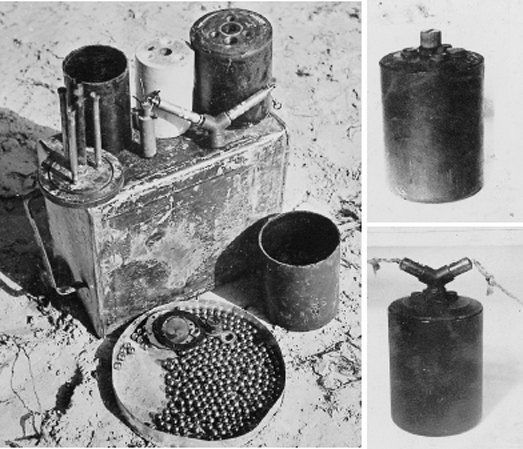
German ‘S’ (shrapnel) anti-personnel mine. Right: fitted with pull igniters and trip wires. Dismantled S mine showing the 3-prong push igniter which operates when a light downwards pressure is applied to one of the prongs. This causes the mine to jump three feet in the air, after which a second explosion hurls the steel balls up to fifty yards.
These various simple but ingenious obstacles were covered by the fire of weapons sited in defensive positions manned by the coastal defense troops along the top of the sea wall. Many of these fire positions were sited in defilade and so protected from the direct fire from ships out to sea. The crescent shape of Sword Beach also provided the Germans with every advantage to pour flanking fire into the sides of any attacking force.
Beyond the immediate beach area there were a series of fortified strong points or resistance nests (Widerstandsnest or WN) that acted as ‘surfaces’ against which assaults would be battered. These strongpoints were sited to cover the beach exits. On 6 June several concrete emplacements were still incomplete in Sword sector, most notably at a strongpoint in Colleville, codenamed ‘Morris’ by the Allies. However, even the partially completed positions were still inherently capable of protecting their resident fighting crews who could then inflict heavy casualties and delays on the 1st Corps troops caught crossing the beach or the open fields beyond. A completed resistance nest normally consisted of approximately between a platoon of thirty men and a company equipped with ten machine guns, and an artillery piece inside a reinforced bunker and a supporting 50-mm cannon.
The Germans had also sited light artillery guns to cover Sword Beach. Reinforced concrete bunkers contained 75-mm or 88-mm guns. Further smaller pillboxes held lighter artillery pieces and additional antitank guns ranging from 37-mm to 75-mm were positioned to cover likely vehicle approaches. Many of the 50-mm and 75-mm guns in use by the German forces were actually Czech or French guns seized back in 1938 and 1940. These various bunker positions were further strengthened by the integration of complete tank turrets (from captured vehicles) or cupolas from the Maginot Line (as at Ouistreham) with their armament. Automatic flame-throwers were also in place at Sword Beach although there are no reports of these grim weapons being fired. Inevitably, the infantry units garrisoning the intervening trenches along the beach were issued with a full range of infantry weapons with a high concentration of machine guns.
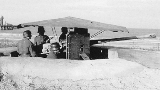
Concete gun emplacement with a 50mm anti-tank gun and crew on the Normandy coast shortly before the invasion.
Indirect fire support could be provided to the forward troops by mortars located in, or to the rear of the fortified strongpoints and by rocket pits sited inland on higher ground. Mortars were usually sited in ‘Tobrouks,’ or open topped reinforced concrete weapons pits, many of which can still be found today amongst remaining German fortifications.
For all their localized, tactical strength the German coastal defences lacked any real depth and Rommel would be severely restricted by Hitler in his use of the operational and strategic reserves so essential to his defensive concept of operations.
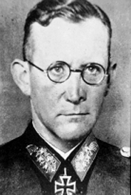
General Erich Marcks.
Generalmajor Wilhelm Richter.
German Forces in the Sword Sector
The men of the 3rd Division were to face units from the Heer, namely the 716th Coastal Defence Division. This formation was part of the LXXXIV (84th) Corps, commanded by the veteran General Erich Marcks. The 716th Division had been stationed on the Normandy coast since 16 March 1942 holding the sector between the rivers Vire and Orne. The Division was under command of Major General Wilhelm Richter whose headquarters was sited in a network of ancient quarry tunnels to the north west of Caen at Folie-Couvrechef (now contained within the grounds of the Peace Museum, Caen). He had assumed command in March 1943. From January to April 1944 his defensive frontage was adjusted or reinforced as additional units from the 77th and 243rd Divisions were integrated into the coastal defences. In May a major adjustment took place when Marcks moved the 352nd Division into the line to the West of the 716th Division’s two forward regiments (the I/726th and III/726th). This move went undetected by the Allies until just before D-Day.
On 6 June the 1st Corps would face:
716th Coastal Defense Division (6 June its total strength was 7,771 men including three battalions of Eastern volunteers each of 600 men). The division consisted of two infantry regiments (the 726th and 736th) with three battalions in each, one coastal artillery regiment with twenty-eight 100 mm T 14/19 guns and twelve rocket launchers. The division also had one battery of eleven Pak 75-mm anti-tank guns and two pioneer companies. The 716 Divisional Pioneer Battalion’s two companies were deployed in Mathieu and Herouvilette. In addition, the Ost Battalion 642 was to assemble in Amfreville once 84th Corps issued the full alert codeword. This force was distributed along the coast in accordance with Rommel’s doctrine:
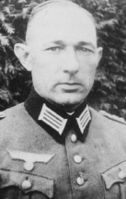
736th Regimental HQ, commanded by Oberst (Colonel) Krug, was located in Strongpoint Hillman (WN 17 south of Colleville) along with the 3rd Company of 642nd Eastern Battalion. Individual companies from 736th were holding strongpoints and the interconnecting outposts within 3rd Division’s area of interest. These strongpoints included those resistance nests codenamed in the Neptune-Overlord plan as Cod (WN 20), and Trout (WN 20A). Along the beach the units were deployed as follows:
10/736th at La Breche d’Hermanville in WN 20.
10th and 4/736th in Colleville-Plage, equipped with two 50-mm guns and one 75-mm gun in WN 20 (Cod).
Additional troops were drawn from 2/736th and 1/736th with Kriegsmarine and Todt Organization personnel manning intervening positions reinforced by four 20-mm mobile anti-aircraft guns covering the beach area from the 716th Flak-Zug.
Inland, several batteries of the 1716th Artillery Regiment commanded by Leutenantoberst Knupe were sited to cover the mouth of the river Orne and adjacent beaches. Knupe had temporarily replaced Oberst Andersen who had gone on sick leave in May. Knupe would be killed in mid-June east of the Orne. On 6 June his units were deployed in three battalion sectors using three artillery groups (left, right, and centre). The units were deployed from West to East as follows:
Self-propelled gun battery (Leutenant Scharf) in Cresserons.
Colleville Battery (B/1716th) in bunkers with four T guns.
Ouistreham Battery: with the 4/1716th battery located at the water tower with four 155 mm F guns (range 10.6 Km) and the 1/1260th in Ouistreham with six 155-mm F guns. One gun was destroyed by bombardment and the remaining guns withdrew to St Aubin-d’Arquenay.
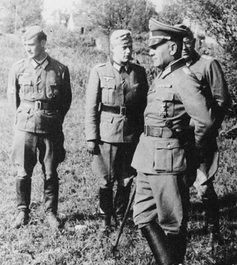
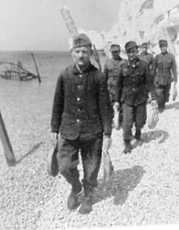
Oberst Krug, commander of 736th Regiment, making an inspection of the defences a few weeks prior to the invasion.
Additional artillery support was available from the forward-deployed artillery units of the 21st panzer Division. The 1/155th Artillery Regiment had three 100-mm guns and four 122-mm R guns from 2/155th in the area of Periers-sur-le Dan. In additional four 88-mm guns from the 2/305th Anti Aircraft Battalion were also located along the Periers Ridge in an anti-tank screen.
This was a strong dual-purpose (indirect fire and anti-tank) artillery force. It could have inflicted even greater loss on Sword Beach and the expanding bridgehead force had it been more effectively directed by the artillery command posts located near Hillman and in the fire direction tower in Ouistreham (this still exists as a museum to the Atlantic Wall).
In his post-war interrogation General Richter, formerly the commander of the 716th Coastal Defense Division, endorsed Rommel’s concept of operations but recognised that what was lacking was positional depth. He had requested a reserve division to be brought up behind his 40-50 resistance points that had been ‘placed along the coastline in the shape of a string of pearls.’ As the Report by Naval Commander Force G stated after the battle ‘the defences gave the impression of too much concrete and not enough spirits...’
A Failure of Military Intelligence?
Only one regiment (the 726th Regiment) from 716th Limited Employment (LE) Coastal Defense Division was believed to be defending Sword sector. The 716th was assessed as being a low quality, over-extended formation with poor morale and about 50% composition of Poles and Slavs in its ranks. It was also under-strength with only 7,771 men, or 35% of the establishment strength of a standard German infantry division.
The 21st Army Group believed that this poor quality division had a frontage of fifty-three miles from the Vire estuary to the Orne-Dives area in the East. As is now known this was not the whole story. Unfortunately a major adjustment of troops had actually occurred in mid-March 1944. Rommel authorized Generaloberst Dollman (commander of the German Seventh Army) to move the 352nd Infantry Division from its reserve location in St Lo to the coastline. Two of its regiments joined the 716th Infantry behind Gold and Omaha Beaches. The division’s third regiment moved to Bayeux as a reserve, where it would be located on D-Day.
From April onwards, Allied intelligence had identified the additional reinforcement of forward positions in several coastal sectors. On 14 May 1944 it became clear that this had occurred in the 716th Infantry’s area of responsibility. Photo-reconnaissance had confirmed this particularly in the area between Isigny and the River Dives but no indication of the move forward by 352nd had been detected. Montgomery’s 21st Army Group staff considered this to be,
‘A most unsatisfactory state of affairs that we cannot specifically identify all elements which go to make up the sector... This much is evident – that we will on D-Day make contact immediately with 716th 709th, 243rd, the fringe of 711th and, within a very short time, 352nd Infantry and 21st Panzer.’
As late as 4 June the Allied 21st Army Group provided what was to prove a very accurate assessment of German adjustments. But by this stage the assault divisions were already in their ships, map packs opened and briefings initiated with all craft awaiting orders to sail for France. The assessment stated:
‘For some time now in other areas coastal divisions have been narrowing their sectors, while divisions the role of which has hitherto been read as lay-back have nosed forward into the gaps provided by the reduced responsibility of the coastal divisions....The evidence that the same has happened on the left in the case of 716th Division is slender indeed...yet it should not be surprising if we discovered that it has two regiments in the line and one in reserve, while on its left 352nd has one regiment up and two to play...’
In the 3rd British Infantry Division’s ‘Intelligence Summary’, the intelligence staff placed the 352nd Division in a dispersed area covering 35-40 miles and with its closest units about fifteen miles from Caen. It was considered to be:
‘Formed from remnants of a division destroyed in Russia. Personnel believed very young or 35-40. Partly mechanised.... Suitably disposed to send troops (? A regt) to strengthen POLAND [codename for Caen], attempt to check the impact of Second Army assault by counter attacks. To stabilise the situation in preparation for the armoured counter attack.
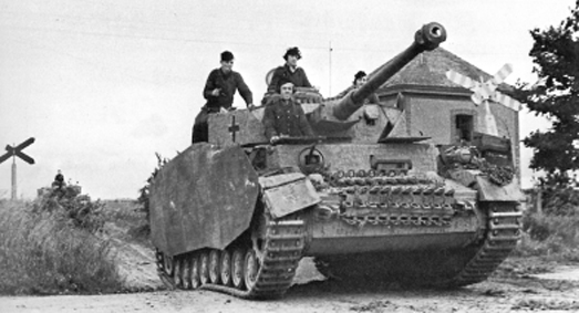
MkIVs of Panzer Regiment 22, 21st Panzer Division in the countryside near Caen in the early summer of 1944.
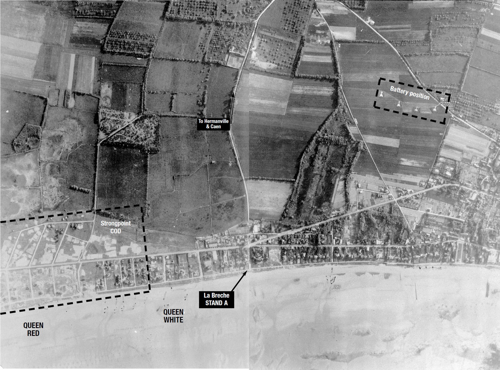
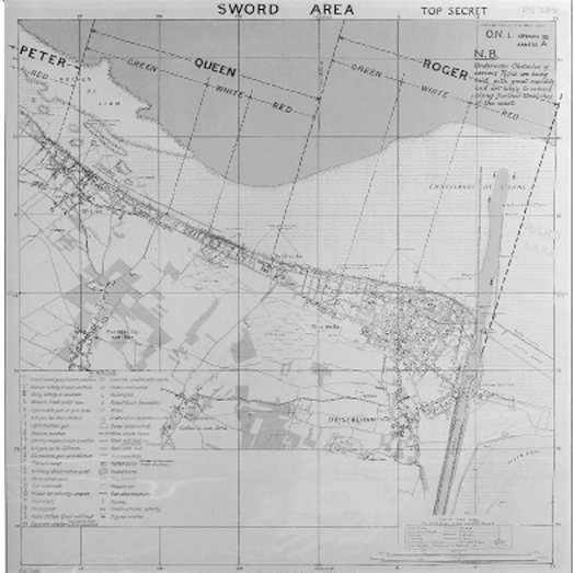
Aerial photograph taken 22 May 1944 covering the area from Queen Red, including Queen White, to Queen Green at Lion-sur-Mer
A further gap in the Allied intelligence picture involved the detailed dispositions of the panzer reserves. At the end of February 1944 General Rennie had believed that 10th Panzer Division was the nearest armoured threat to Sword Beach. This force could be expected to strike Sword sector within four hours of receiving orders to move. To that end Rennie placed a heavy emphasis on the probability of meeting armour on D-Day. By the time the final Divisional Intelligence Summary was issued on 16 May 1944 the 21st Panzer Division was assessed as being in a general area some ten to thirty miles south of Caen. It was assumed that units from 21st Panzer Division would be met on D-Day. On 21 May SHAEF accepted what ULTRA had actually already confirmed on the 14th: the 21st Panzer Division had moved into forward around Caen. Air reconnaissance and sighting reports of tank transporters and tank tracks in open fields had confirmed that:
‘The division is now close to Caen with its tanks apparently east of the Orne. The exact area of the division and its dispositions are not known, but on any reckoning it now lies but a short run from the eastern beaches of the Neptune area.’
Montgomery, Dempsey, and Crocker were certainly clear on the implications of this threat. At his 23 May briefing to his senior commanders, Dempsey estimated that the 21st Panzer Division would be met early on D-Day with 12th SS Panzer Division entering battle by the evening of the invasion.
Preparing the 3rd Division for the Mission
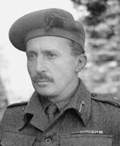
At Christmas 1943 Major General T G Rennie DSO, MBE had taken over command of 3rd Division from Major General Lumsden. Rennie was an experienced commander. He had escaped from the German advance in 1940 from St Valery and had then gone on to fight the Afrika Korps in the Western Desert with 51st Highland Division.
From December 1943 through to May 1944 the 3rd Division participated in a series of seven major exercises that tested many aspects of landing this complex force on a hostile shore. BURGER 1 and BURGER 2 were conducted from the Black Isle to Burghead Bay in the Moray Firth, in order to practice the whole process of marshalling the landing troops within a beach sub-area. Exercises SMASH and GRAB were both conducted in severe weather conditions during January 1944. In February, Exercise CROWN was the last exercise during which the 3rd Division practiced a two-brigade assault. In late February Exercise ANCHOR tested the concept of assaulting Sword Beach with three brigades in echelon. Exercise LEAPYEAR followed and was the last exercise conducted by the Division in the Moray Firth before the troops and their equipment were moved south into wooded areas of Hampshire and Sussex and their final embarkation camps.
The most significant exercise codenamed FABIUS IV then occurred on 3-4 May. The purpose of this exercise was to test the arrangements for marshalling troops and vehicles, movement to the embarkation points, and the process of embarking in the correct assault groups onto the attendant ships of Force S. The troops were then landed on beaches between Littlehampton and Bognor. After FABIUS was over the troops settled into a routine in their tented camps of final preparations, fitness training, and the inevitable equipment inspections.
Major General T. G. Rennie, DSO, MBE.
A notable highlight for the troops in mid-May was the introduction of a system of 32-hour passes that enabled the men to get away from their restricted accommodation. Even this came to an end at midnight on 26 May 1944 when the camps were sealed with barbed wire and guarded by armed patrols from static units. There would be no more visits to the local pub until the veterans were once again back in Britain.
Detailed briefings now began and brigade commanders briefed their subordinate commanding officers in specially prepared briefing centres that were also individually guarded. Over the next four days a sequence of briefings were given. French Francs were issued along with a guidebook to France. Some of the more cynical troops believed that this was just another deception plan.
Between 26 and 30 May the assault force was briefed in detail using sophisticated terrain models, air photographs and diagrams. Each briefing could take up to seven hours. There was a great sense of satisfaction and confidence; everybody knew their role in this ‘great enterprise.’ As the briefing phase came to a close the troops were moved from their camps and established in the temporary Marshalling Camps where men and vehicles were organised in to ship loads. Battalions of the Assault Brigade were each divided into two LSIs along with many smaller units that would land in the initial waves. Most of the 3rd Division embarked either in or around Portsmouth. 185 Brigade and the first reinforcements for 8 Brigade and the KSLI embarked at Newhaven in their LCI (L). Those not landing until the third tide embarked in London or Tilbury. So by 3 June 1944 most of the Division was aboard their ships.
The following day General Eisenhower made his decision to postpone D-Day for twenty-four hours. The waiting soldiers passed the time playing ‘Housey-Housey’, or doing more fitness training. On 5 June the decision to go was confirmed. D-Day would be 6 June 1944. The ‘Great Crusade’ was on.
3rd Division: Assault Landing Plan
The 3rd Division’s Operations Order had been issued on 14 May, replacing the earlier Operational Planning Instructions and the first draft of the Operations Order. Two days later the Briefing Intelligence Summary was issued. The order stated that the Division would be landing on QUEEN WHITE and RED Beaches and then advancing to capture Caen and crossings over the River Orne within the city. This would be done using an assault brigade (8 Infantry Brigade and attached No.4 and No.41 Commandos), an Intermediate Brigade (185 Brigade), and a Reserve Brigade (9 Brigade).
The landing plan directed that four LCTs each carrying four amphibious DD Sherman tanks from the 13/18 Hussars would put their fragile loads ashore at H-5 minutes. These secret weapons would then be followed by four further LCTs that would beach and deploy specialised armour from the 79th Armoured Division. These were ‘Hobart’s Funnies’ that included flail tanks from the 22nd Dragoons, Crocodile flamethrower tanks, AVREs equipped with Petard mortars each capable of destroying fortifications and bunkers with their main armament. This armoured force would act as the spearhead for the assault companies.
While the armour would be engaging the German defences, Royal Engineer assault groups organized into breaching or gapping teams were to clear beach obstacles for the follow-on elements from the Division and 1st Corps. Their task was to cut a series of gaps through the ‘petrified forest’ of obstacles and mark them for follow-on craft. They would have to work fast before the rising tide (rising 20 feet in places on D-Day) covered many of the obstacles after only 30 minutes. The engineers would be supported by tanks from the 79th Armoured Division fitted with bulldozer blades landing at H+35, each tank being capable of pushing obstacles out of a boat lane or crushing them into the sand.
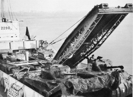
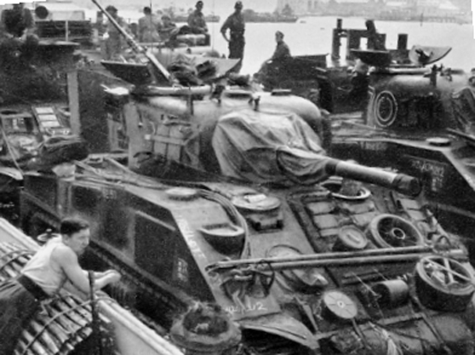
Sherman and Churchill tanks loaded up and ready to make the trip across the Channel. Engineer assault vehicles including bridge layer, and flail tank.
As an initial toehold was being established, the two leading infantry companies would beach at H+7 in eight assault landing craft. At H+20 another eight LCAs would land two more infantry companies. This force would then work together to clear the German defences covering the beach. Particular emphasis was placed on clearing strongpoint Cod – an objective for both leading assault battalions. These battalions were to then push inland up to the first lateral road running from Riva Bella to Bas Lion, codenamed Pike, and thence onto their battalion objectives at Hermanville and Colleville. 8 Brigade’s objective area actually contained five strongpoints Cod, Sole, Daimler, Hillman and Morris excluding the extensive flanking fortifications in Riva Bella and Ouistreham that would be cleared by the Commandos. Brigade, and divisional objectives then extended from Periers to as far south as Caen. This meant that 1st Corps (including 3rd Canadian on the right flank) had the task of establishing a beachhead some four to ten miles deep and fourteen miles wide.
Key brigade and battalion level tasks included securing objectives on the prominent ridge of high ground to the north of Caen called Lebisey Ridge. This and other planned D-Day objectives would act as blocking positions to the inevitable German counter-attack. This extensive bridgehead would also provide 1st Corps with sufficient depth to build-up troop and logistic strength for subsequent operations and give security to the vulnerable landings of follow on units during the early stages of the invasion. Behind this shield, Crocker would deploy his divisions, and link up with the 6th Airborne Division at Benouville and beyond the Orne.
At H+25 two LCAs would land the Beach Group support teams to help establish order on what could quickly become a fairly chaotic strip of fire-drenched beach. At H+60 nine LCTs would land the 105mm self-propelled artillery guns or Priests; and thirty minutes later additional tanks would beach from ten LCTs. The tenth wave would consist of twenty-one DUKWs carrying ammunition, other combat supplies and additional towed artillery. The all-powerful Beachmasters would choreograph this complex landing schedule. They would be directing forces into and then away from the beach in order to clear the shoreline for follow-up waves of men and equipment. Using flags and radio they would attempt to control the flow of assault craft from their lowering position in to the beach as the morning’s events unfolded. The planning had been thorough, the rehearsals effective. Now 3rd Division would face its first action since the debacle at Dunkirk in 1940. A summary of brigade tasks is given below:
8 BRIGADE
Brigadier E.E. ‘Copper’ Cass CBE DSO MC
1 Suffolk: LtCol. R.E. Goodwin DSO
2 E Yorks: LtCol. C.F. Hutchinson
1 S Lan R: LtCol. J.E.S. Stone
8 Brigade Defence Platoon
8 Brigade with under command 13th /18th Hussars (H), 5 Assault Regiment RE and 4 and 41 Commandos were to secure the beachhead to include the high ground about Periers-sur-le-Dan and St Aubin d’Arquenay. Other specific tasks included destroying the battery positions codenamed Daimler (by the water tower at Ouistreham), Morris, and Hillman.
The Brigade Operations Order No.2 was issued on 22 May. It went into great detail about the tasks for each unit under command. The intention was clear: land and capture the Periers-sur-le-Dan feature. To this was added the specific battalion objectives. Thus the two assault battalions – the 2 East Yorks on the left and the 1 South Lancashire Regiment on the right – were to destroy the enemy holding the beach defences. The reserve battalion – 1 Suffolk – was to capture Colleville-sur-Orne and the battery (Morris) to the west, and Hillman that dominated the Periers feature on the Brigade centerline. This area would then act as a firm base for the subsequent exploitation by the Division in the critical attack on Caen.
185 BRIGADE
Brigadier K.P. Smith OBE
2 Warwicks: LtCol. H.O. Herndon
1 Norfolk: LtCol. R.H. Bellamy DSO
2 KSLI: LtCol. F.J. Maurice DSO
185 Brigade Defence Platoon
185 Brigade supported by the Staffordshire Yeomanry were to land at approximately H+1.5 hours and advance to capture Caen and a bridgehead south of the city over the River Orne. This was to be carried out with speed and boldness; the sentence was underlined for extra emphasis in the orders.
185 Brigade’s operations order described how Caen would be taken in a four phase operation. Initially a mobile column of the KSLI with a troop of 41 Anti-Tank Battery equipped with Self-Propelled guns, the Staffordshire Yeomanry and two troops of the Westminster Dragoons (equipped with flail tanks to clear mines) was to secure Caen as quickly as possible. The main body were to follow to move up with the 2nd Warwickshires on the right and 1st Norfolk Regiment on the left. The expected timing was that the whole brigade, including artillery and tanks would be complete by H+4 hours with Bren Carriers and towed anti-tank guns arriving an hour later: a simple and well-understood plan. Sadly it would not survive first contact with the enemy.
9 BRIGADE
Brigadier J.C. Cunningham MC
2 Lincolns: LtCol. C.E. Welby-Everard
1 KOSB: LtCol. G.D. Renny
2 RUR: LtCol. I.C.H. Harris
9 Brigade Defence Platoon
The Reserve Brigade with the East Riding Yeomanry in support was to move initially to concentration areas around Plumetot. The Brigade was mobile with two battalions on bicycles. It was given a number of possible tasks that would be carried out on the order of the Divisional commander. The main task was to move forward and provide right flank protection to 185 Brigade and linking up with the Canadians moving inland from Juno Beach. In the event of 185 Brigade failing to take Caen it was tasked to attack the city from the west.
The 9 Brigade plan instructed 2nd Lincolns to clear the Brigade concentration area south of Lion-sur-Mer and be prepared to take Cresserons and Plumetot. The KOSB and RUR were to then advance to their objectives at St Contest and Malon accompanied and supported by the East Riding Yeomanry.
1ST SPECIAL SERVICE BRIGADE (later 1st Commando Brigade)
Brigadier The Lord Lovat DSO, MC
No. 3 Commando (Army) Lt Col. Peter Young DSO, MC
No. 4 Commando (Army) Lt Col. Robert Dawson
No. 6 Commando (Army) Lt Col. Derek Mills-Roberts DSO, MC
N0. 45 Royal Marine Commando Lt Col. Charles Ries RM
Each Commando consisted of 24 officers and 440 other ranks. The men were divided into troops each of three officers and sixty men.
This included Nos. 1 and 8 French Troops of No. 10 Inter-Allied Commando (under the command of Commandant Philippe Kieffer).
1st Special Service Brigade was to land on Queen Red and execute intermediate missions before linking up with 6th Airborne Division when it would revert under command of General Gale. Its final D-Day objective was to help secure the eastern, seaward, flank of the beachhead in the area of Le Plein, Amfreville and Hauger. A task that the brigade would sustain with reinforcements from 4th Special Service Brigade for over eighty days:
0755 hours No. 4 Commando and Nos. 1 and 8 French Troops were to land and silence the Casino strongpoint and clear Ouistreham, which included destroying the coastal defence battery consisting of six 155mm guns. Once the mission had been executed the Commando would revert under command and rejoin 1st Special Service Brigade.
0840 hours Lovat’s brigade headquarters and No. 6 Commando would land and move inland rapidly and link up with unites of 6th Airborne Division at Pegasus Bridge and the cross the canal and river before moving north east and securing the high ground around Amfreville.
0910 hours No. 3 Commando and 45 Royal Marine Commando were to land and support Lovat’s operations in Amfreville. In addition, 41 Commando was similarly tasked to clear the coastline to Luc-sur-Mer and then revert under command of 4th Special Service Brigade.
27 (INDEPENDENT) ARMOURED BRIGADE
Brigadier G E Prior Palmer
The 27 Armoured Brigade consisted of three armoured regiments: the 13th/18th Hussars, the Staffordshire Yeomanry, and the East Ridings Yeomanry, under command of Brigadier Eroll Prior-Palmer. The brigade was temporarily attached to 3rd Division for the assault. 13th/18th Royal Hussars (QMO) was in support of 8 Infantry Brigade in the lead echelon with A and B Squadrons in support of the two assault battalions. The third squadron was attached to the Suffolks for their tasks at Periers Ridge. Once individual squadron and regimental task had been achieved the brigade was to concentrate as soon as its individual regiments became available and then support operations on Caen. The Brigade was equipped with 190 Shermans and 33 Stuart light tanks. One unit, the 13th/18th Hussars, would deploy from their LCTs 5,000 yards out to sea and strike out for shore in their unseaworthy Duplex Drive (DD) ‘amphibious’ Sherman tanks. The other two armoured regiments of 27 Armoured Brigade were both equipped with Shermans and Stuarts. The brigade numbered 3,400 all ranks and 1,200 vehicles; a sizable addition to the division.
By D+6 the tanks would be retasked east of the Orne to support the defense of the 6th Airborne Bridgehead.
From Plan to Action
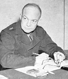
After a period of settled weather at the end of May the forecast for 5 June (provisionally selected as D-Day) had deteriorated to such an extent that Eisenhower postponed the invasion by twenty-four hours. At the 2145 hours conference on Sunday 4 June, Group Captain Stagg Chief Meteorological Officer at SHAEF, could announce a period of ‘relatively good weather’ on 6 June. Eisenhower then said, after some debate with Ramsay, Montgomery, Tedder, Leigh-Mallory, and Bedell Smith:
‘Well, I am quite positive we must give the order; the only question is whether we should meet again in the morning. Well I don’t like it but there it is. Well boys, there it is, I don’t see how we can possibly do anything else.’
Thanks to efforts of the meteorological staff, a short window of opportunity had been identified, enabling the Supreme Allied Commander to launch D-Day on 6 June.